Welcome to our Nootka Trail Guide! This resource includes information and tips to help plan your adventure on Nootka Island. To skip to a specific topic of interest, use the quick links below for easier navigation.
Table of contents
- Highlights
- Overview
- Map
- Guide Book
- Fees
- Access
- Air Nootka
- MV Uchuck III
- Shorebird Expeditions
- Accommodations
- Weather
- Tides
- Route
- Campsites
- Trip Reports
- Tongue Point to Yuquot – June 12-15, 2024
- Tongue Point to Yuquot – June 13-17, 2022
- Tongue Point to Yuquot – June 26-30, 2021
- Starfish Lagoon to Yuquot – September 4-8, 2018
- Starfish Lagoon to Yuquot – August 4-8, 2018
- Starfish Lagoon to Yuquot – July 7-11, 2018
- Starfish Lagoon to Yuquot – August 22-26, 2017
- Starfish Lagoon to Yuquot – June 25-29, 2016
Highlights
- Immersed in First Nations history. The Nootka Trail passes through the traditional lands of the Mowachaht/Muchalat First Nations. Making an effort to learn about their history encourages a respectful awareness and a richer hiking experience.
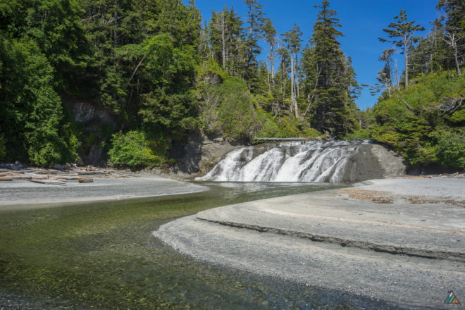
- Beautiful wilderness camping. The main primitive campsites are located on gorgeous sandy beaches or clean pea gravel mounds. Calvin Falls is a highlight with its refreshing falls and tidal swimming creek. Evening sunsets are colourful and serene.
- Fewer human encounters. The remote location of Nootka Island and the logistics of getting to the trailhead (seaplane or water taxi) means that fewer people hike this trail. One might travel the entire route and not see another human until Yuquot.
- Frequent wildlife observations. Because fewer humans hike this trail, wildlife can be seen in their natural environment more often. Black bears, wolves, river otters, eagles, ravens, and sea birds are familiar friends along the way.
- Majority of hiking on beach. More beach hiking means fantastic views, exciting terrain, fresh air, and better chances to see wildlife. The intertidal obstacles and shifting pebbles are challenging to hike on, but the rewards are endless for the eyes.
Overview
- Location: West Coast of Nootka Island, British Columbia, Canada
- Recreation area: Outer Coast Nootka Island REC16199
- First Nations: Mowachaht/Muchalaht
- Distance: 37 km
- Duration: Typically completed in 4-8 days, depending on fitness and desire
- Difficulty: Complex coastal and rainforest terrain (someone in group should be experienced)
- Open: Year round, services seasonal
- Peak season: July to September
- Permits: Trail passes payable to Mowachaht/Muchalaht
- Fees: First Nations land crossings
- Reservations: Recommended for floatplanes, water taxis, and MV Uchuck III
- Pets: Not recommended
- Maximum group size: Air Nootka = 6 in largest floatplane; MV Shorebird = 10 in water taxi
- Trailheads: Starfish Lagoon, Tongue Point, Yuquot (Friendly Cove)
- Shuttles: Air Nootka floatplane, Shorebird Expeditions water taxi, or MV Uchuck III ferry
- Cable car crossings: None
- Camping: 5 – 7 sites (water sources, no food caches)
- Structures: Ropes
- Major shipwrecks: Greek freighter Treis Lerarchi
- Geologic features: Rock shelves, sea stacks, sandstone cliffs, headlands, water erosion
- Wildlife: Gray whales, humpback whales, orcas, seals, sea lions, black bears, wolves, cougars, eagles, ravens, sea birds, river otters, slugs, intertidal animals
- Weather: Heavy rain, cool temperatures, high winds, damp fog, sun
- Hazards: Slippery roots, deep mud, steep slopes, washouts, blowdowns, fallen logs, tide problems, deep sand, pebbles, boulders, tidal shelves, rocky shorelines, impassible headlands, creek crossings, tidal creeks, tidal lagoons, tsunamis, rogue waves, floods, landslides
- Emergency help: There is no cell phone service on Nootka Island (we carry a satellite messenger)
Map
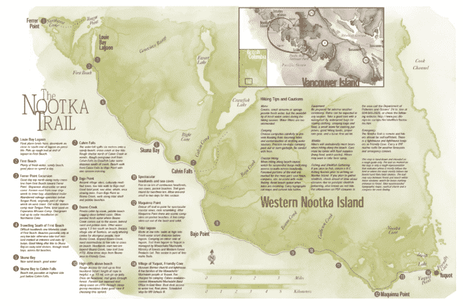
Federation of Mountain Clubs of BC (FMCBC) created, published, and distributed the Nootka Trail map, and promoted the conservation of West Nootka Island. This general interest map is not suited to navigation. Instead, it highlights special points of interest and offers tips to make your hike more enjoyable.
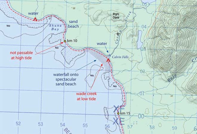
John Baldwin’s Nootka Island paper map is the best for navigation. The route is marked on a 1:50,000 scale topographic map and includes information on distances, campsites, tide cut-offs, sources of drinking water, and other interesting features.
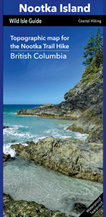
In 2024, Philip Stone at Wild Isle Publications acquired John Baldwin’s coastal map publishing business and printed an updated version.
- Stone P. Nootka Island: Topographic map for the Nootka Trail Hike. Scale 1:50,000. Wild Isle Publications. 2024. www.wildisle.ca
Guide Book
We use three guidebooks to plan hiking trips on Nootka Island. Taryn Eyton, Tim Leadem, and Philip Stone each have detailed Nootka Trail chapters in their guide books. Pair these essential books with John Baldwin’s map for trip planning.
- Eyton T. Backpacking on Vancouver Island: The Essential Guide to the Best Multi-Day Trips and Day Hikes. Greystone Books. 2024. www.greystonebooks.com
- Leadem T. Hiking the West Coast of Vancouver Island: An updated and comprehensive guide to all major trails. Greystone Books. 2015. www.greystonebooks.com
- Stone P. Coastal Hikes: A Guide to West Coast Hiking in British Columbia and Washington State. 1st ed. Wild Isle Publications. 2007. www.wildisle.ca
Fees
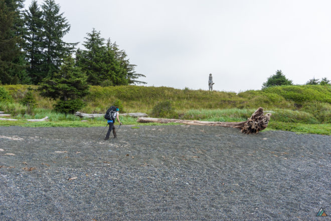
Mowachaht/Muchalaht First Nation collects fees to hike the Nootka Trail. Purchase your hiking passes online or have cash ready to pay the fees in Yuquot.
- Adult ($75)
- Youth ($25, 12 and under)
- Senior ($50, 65 and over)
Access
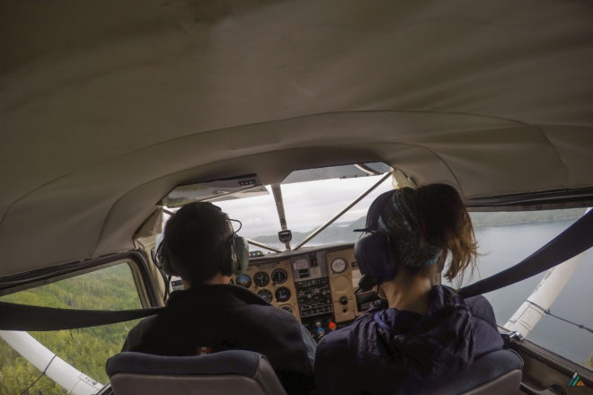
Access to and from Nootka Island is by Air Nootka, Shorebird Expeditions, or the MV Uchuck III. The main staging areas are Gold River and Tahsis. One method is to charter Air Nootka from Gold River to Starfish Lagoon, hike the trail in the southeast direction, and get picked-up by the MV Uchuck III for a ride back to Gold River. Another option is to start in Tahsis, ride the Shorebird Expeditions water taxi to Tongue Point, and get picked-up by the water taxi in Yuquot (Friendly Cove) for a ride back to Tahsis. A third option is to take the Uchuck III from Gold River to Yuquot and yo-yo the trail, returning to Gold River on the Uchuck III. Reservations are highly recommended no matter which mode or combination you choose. Prices were accurate at the time we published this post, but may change anytime. Contact the service providers directly for current costs.
Air Nootka
Base: Gold River
Website: www.airnootka.com
Phone: 1-250-283-2255 (Toll free: 1-877-795-2255)
Email: info@airnootka.com
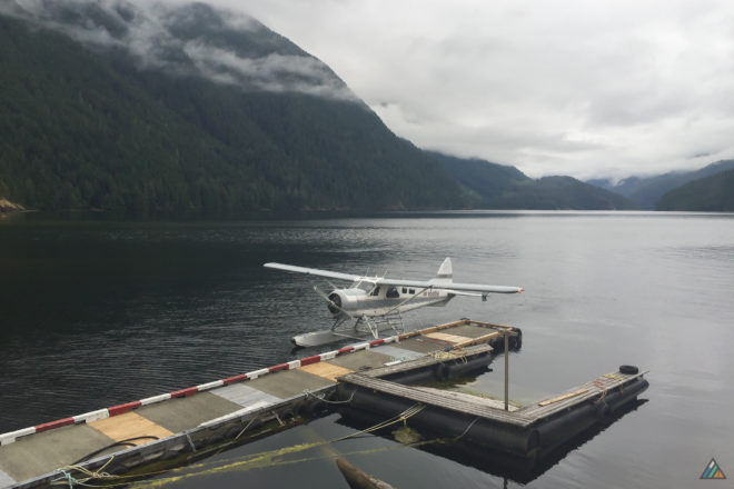
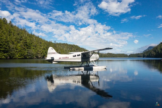
Air Nootka drops hikers off at the Starfish Lagoon trailhead in either the Cessna or the Beaver. Each flight is a charter, which means the cost is based on booking the airplane. There is no per person fare. It is possible to get picked up at Starfish Lagoon. This sometimes needs to be done in more than one trip due to the short “runway”. In this case extra charges will be incurred.
The Cessna 185 can take up to 3 passengers. It carries a total passenger and baggage weight of 700 pounds. The DeHavilland Beaver can take up to 6 passengers. It carries a total passenger and baggage weight of 1200 pounds. It is helpful to know your body weight and baggage weight at the time of booking, although there is a scale at the plane terminal for measuring weights prior to boarding.
- Gold River to Starfish (Louie) Lagoon drop-off charter: $897.75* per Cessna run (1-3 passengers)
- Gold River to Starfish (Louie) Lagoon drop-off charter: $1228.50* per Beaver run (1-6 passengers)
- Yuquot (Friendly Cove) pick-up charter to Gold River: $472.50* per Cessna run (1-3 passengers)
- Yuquot (Friendly Cove) pick-up charter to Gold River: $630.00* per Beaver run (1-6 passengers)
*all taxes and fees included
At the time of booking your flight, Air Nootka will need:
- Each passenger’s first and last name
- Each passenger’s weight
- A telephone contact number
- A credit card number to hold the reservation
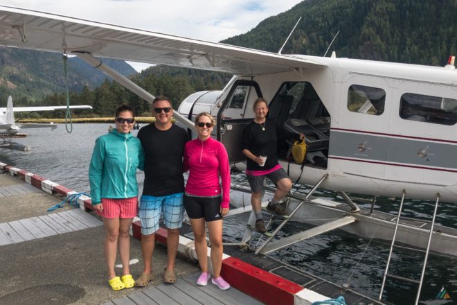
Air Nootka asks that if you are packing bear bangers, bear spray, or camp stove fuel, to have these items easily accessible as they need to be stowed in the float compartment for the flight. Air Nootka requires passengers arrive 45 minutes prior to departure to weigh packs, separate out dangerous goods, and pay for the flight.
After the floatplane lands in Starfish Lagoon and gets as close to shore as possible, you disembark into the water. Watch where you step as there really are starfish in Starfish Lagoon! The pilot will retrieve the backpacks from the cargo hold and pass them to hikers to carry ashore. The water can be anywhere from ankle to knee-deep. There is a small, wet beach at Starfish Lagoon where you can change from your water shoes into your hiking boats. There is nowhere to camp here. The rugged rainforest hiking starts immediately. It is about 45 minutes to the first camp at Third Beach.
Here are a few additional tips that we find helpful for a float plane journey with a water-exit:
- Have your backpack packed and “hike-ready” before you arrive at the plane terminal. There is no time for disorganization as the pilot will want to do pre-flight preparations.
- Make sure your trekking poles and boots fit inside your pack, or separate these items from your pack so they can be easily stowed under the seats.
- Keep bear spray, bear bangers, and camp stovefuel in a separate bag for the pilot to stow in the float compartment.
- Wear shorts and water shoes. We used Crocs which doubled as camp shoes. Swimsuits are not required.
- Keep a pair of hiking socks near the top of your pack, or in an easily-accessible pocket, so you can put them on with your boots once your feet dry out.
- Fill up your water bottles. There is no drinking water at Starfish Lagoon.
MV Uchuck III
Base: Gold River
Website: www.getwest.ca
Phone: 1-877-824-8253
Email: reservations@getwest.ca
Schedule
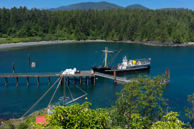
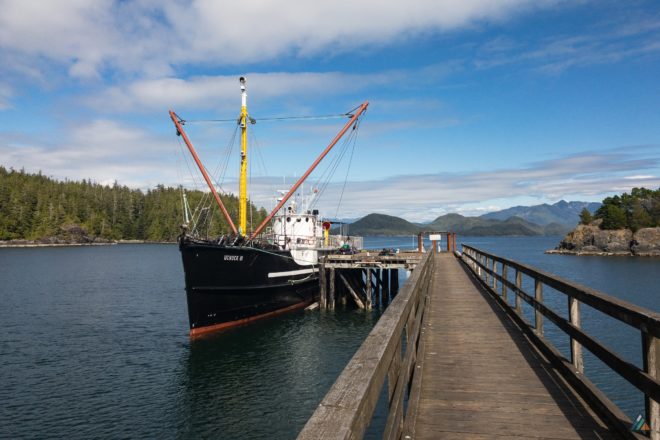
The MV Uchuck III is a 1942 converted minesweeper that ships cargo for communities in Nootka Sound and Kyuquot Sound. It also provides seasonal passenger services for hikers, kayakers, residents, and holiday cruisers. Booking the Uchuck III for passage back to Gold River is the perfect way to extend your Nootka Island adventure. There are excellent opportunities for marine wildlife sightings, especially whales and birds.
The vessel can take up to 100 passengers and carry 70 tons of freight. The Uchuck III has been nicely refurbished for a comfortable journey. There is a wood-finished lounge plus cafe with homemade food, books for sale, and walls covered in historic photos, nautical charts, and interpretive plaques. Plenty of open-air seating is available, either in quiet corners or in the middle of all the action. The crew is super-friendly and passionate about working on this historic ship.
- Yuquot (Friendly Cove) to Gold River: $100.00 per adult / $72.00 per child (6-12)
Here are some additional tips to maximize your Uchuck III experience:
- The Uchuck III does not sail to Yuquot every day. Check their seasonal schedule to plan your trailhead exit, otherwise you may be waiting for days.
- On your last trip day, allow extra time to rest and explore Friendly Cove. From the lighthouse, dock, or beach you can watch the vessel on approach and observe the crew operate the massive windlass to transfer cargo.
- Change into clean, dry clothes for a more comfortable voyage.
- Before boarding, neatly load all loose gear into your backpack. Stow your hiking poles. We strapped our packs to a railing on the main deck, out of the way of crew and passengers.
Shorebird Expeditions
Base: Tahsis
Website: shorebirdexpeditions.com
Phone: 1-250-218-1145
Email: sarah@shorebirdexpeditions.com
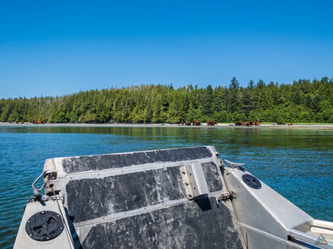
The water taxi is an option for hikers who don’t want to use a floatplane. The MV Shorebird drops hikers off at Tongue Point and picks hikers up at the Yuquot (Friendly Cove) dock.
- Tahsis to Tongue Point drop-off charter: $550.00 per run (max 10 passengers)
- Yuquot (Friendly Cove) pick-up charter to Tahsis: $450.00 per run (max 10 passengers)
- Fuel surcharge of $25 per passenger over five passengers per run
Here are some additional tips to maximize your Shorebird Expeditions experience:
- Meet water taxi at the Westview Marina & Lodge fuel dock.
- Paid parking is available at the Westview Marina & Lodge.
- The landing at Tongue Point might be wet.
Accommodations
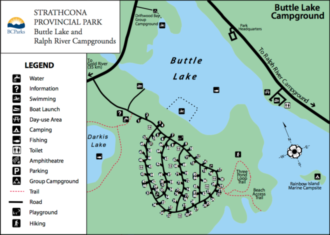
Gold River and Tahsis are the usual staging areas for the Nootka Trail. Accommodations in town are limited and book up quickly in the high season. There are a few options east of Gold River, including lodging and camping in Strathcona Provincial Park. Reservations are recommended.
Strathcona Park
Buttle Lake Campground
Website: bcparks.ca
Make a reservation online
Strathcona Park Lodge
Website: strathconaparklodge.com
Phone: 1-250-286-3122
Email: info@strathconaparklodge.com
Gold River
Baymont by Wyndham – Opening Soon!
Website: explorenootka.com
Email: welcome@yuquot.ca
Ridgeview Motor Inn
Website: ridgeview-inn.com
Phone: 1-250-283-2277 or 1-800-989-3393
Email: ridgeview395@gmail.com
The Lodge at Gold River
Website: thelodgeatgoldriver.ca
Phone: 1-250-283-2900
Email: steelhead@thelodgeatgoldriver.ca
Tahsis
Moutcha Bay Resort
Website: www.nootkamarineadventures.com
Phone: 1-877-337-5464
Email: info@nootkamarineadventures.com
Westview Marina & Lodge
Website: www.westviewmarina.com
Phone: 1-250-934-7672 or 1-800-992-3252
Email: info@westviewmarina.com
Weather
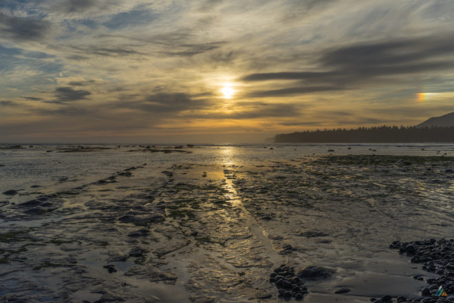
We study the weather before our trip using a few different resources. On trip we check the weather daily with a satellite messenger. You will be hiking in a temperate marine climate. Be prepared for all kinds of weather!
Tides
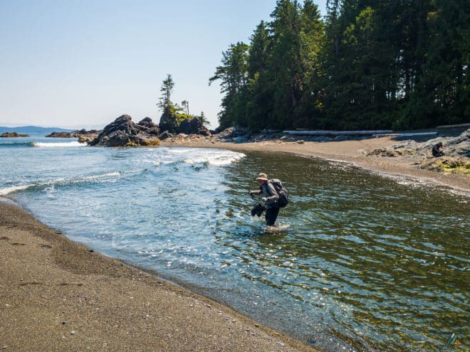
Tide problems along the Nootka Trail involve cliff cut-offs and tidal creeks or lagoons. We list the main ones, but other stretches may be problematic at higher tides depending on wind and waves. Beach terrain is rearranged every year from storm action. Plan accordingly by carrying tide tables and knowing how to use them. We use the Saavedra Islands – 08645 tide tables.
- Skuna Bay east: 10 km
- Calvin Creek: 12.5 km
- Beano Creek: 22.5 km
- Beano Bay east: 24 km
- Tsa’tsil Lagoon: 32.5 km *
* Tsa’tsil Lagoon is the most significant tidal obstacle on the Nootka Trail. When the tide lowers, water rushes out of the lagoon and creates a strong current. When the tide rises, the outflow zone deepens. Depending on tidal phase and body height, your crossing could be anywhere from ankle-deep to waist-deep. Our groups have had to wait on the beach from time to time, having dinner on the west shore as the lagoon was too hazardous to hike through.
View updated tide tables for your trip dates:
- Saavedra Islands – 08645 – 7 day and hourly prediction tide tables provide predicted times and heights of the high and low waters.
Route
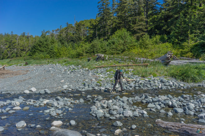
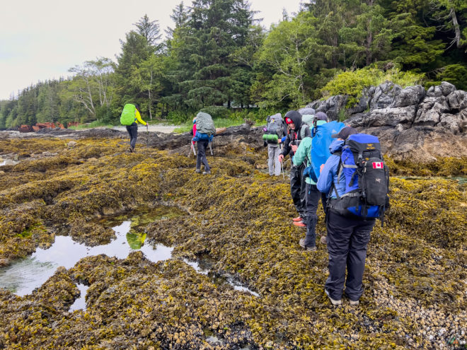
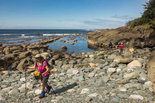
The Nootka Island Trail is a challenging coastal experience. Approximately 75% of the route consists of beach hiking and 25% is forest hiking. There is not much total elevation gain. The beach sections contain all the usual features: logs, deep sand, wet sand, pea gravel, pebbles, tidal shelves, sloped surfaces, seaweed, algae, boulders, creeks, rocky headlands, sandstone, tide problems, tidal rivers, and lagoons. All surfaces are potentially mobile and slippery like ice. The rainforest sections has its own challenges: steep overland stretches that required the aid of ropes, blowdowns to crawl over or under, bogs with knee-deep mud, slippery roots, limestone cliffs, and overgrown salal. The difficulty of this hike would increase with rain or wind. Forest entrances are marked with floats hanging from trees. There are no man-made wooden structures like bridges, boardwalks, or ladders. The Nootka Trail has a rocky gully at the end of the one-kilometre crescent beach east of Beano Creek camp. The gully floods with higher tides. There are two ropes to choose from, one up a smooth, mossy slope and one up a rockier section with more hand-holds. This slippery scramble can be avoided by taking the first forest bypass access a few hundred metres west of the gully. The bypass trail must always be used at higher tides to avoid cliff cutoff.
Campsites
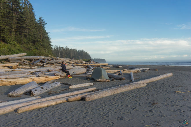
Recreational Sites & Trails BC and the Mowachaht/Muchalaht First Nations are actively collaborating on land management and stewardship. Seven green throne toilets were installed in 2022/2023 (Third Beach, Skuna Bay, Calvin Falls, Beano Creek, Calcium Creek, Pocket Beaches, Sea Caves) and three remain at the dock in Yuquot. Unfortunately several of the green thrones are full as of 2024 and unusable. Composting outhouses would be a better long term human waste management solution. Food lockers would be a good addition to the campsites infrastructure too.
Third Beach
After the floatplane drop-off, Third Beach Camp is about a 1 km rainforest hike south. The beach is long and sandy, with an excellent water source. Collect as far upstream as possible to reduce the chance of brackish water. It’s a good place to relax and camp for the first night, no matter what time you arrive. After set-up, there is the opportunity for a day-hike towards Tongue Point if the tides are in your favour. There is shipwreck debris from the Greek freighter Treis Lerarchi at Tongue Point. The largest camp area with the most driftwood furniture appears to be near the creek. There is a smaller area at the west end of the beach near the sea stack.
Skuna Bay
There is a camp just before the west entrance to Skuna Bay near a good water source. It is a decent place to stay if you didn’t have the energy to make it to Calvin Falls, if the tides are not in your favour to solve tide problem east of Skuna Bay, or if you had extra trip days to play with. Calvin Falls is the nicer camp if you have a choice between the two.
Calvin Falls
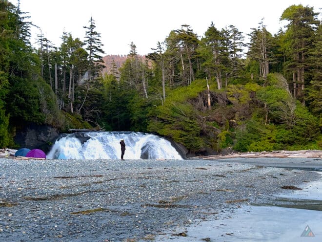
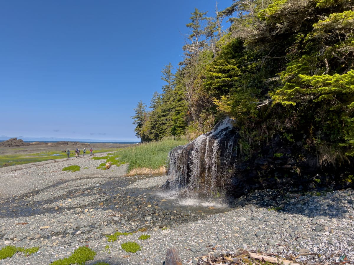
The camp at Calvin Falls is probably the best camp on the Nootka Trail. It sits in the middle of a spectacular sandy beach and is situated right at a gorgeous waterfall. The falls are the terminus of Calvin Creek which drains Crawfish Lake. After camp set-up, the sandy-bottomed pool beneath the falls is an excellent place for a swim. Collect fresh drinking water from the actual flowing falls to eliminate the possibility of a brackish sample. Calvin Creek and the pool flood with high tide. The creek should be forded as soon as it is safe. We forded the creek at the end of our hiking day and camped on the south side so we didn’t have to cross in the morning.
Beano Creek
The camp at Beano Creek is a welcome sight after hours of hiking along pea gravel. The creek is tidal and can only be forded when waters are low and safe. The camp itself is on a huge mound of clean pebbles that gets moved around and reconfigured by waves and storms. This camp is close to some private cabins so there may be other people already here. There is a side creek on the south shore upstream which is a good place to collect water. Beano Creek is considerably brackish and not good for drinking unless you go really far upstream.
Pocket Beaches
Between Beano Creek and Sunrise Beach are several possible camp spots with no particular names. These smaller pocket beach camps are not the nicest on the trail, but will definitely suffice. Some are near decent water sources. Callicum Creek is the best and most reliable source in this section of the Nootka Trail.
Sunrise Beach
The sandy beach 700 m southwest of Tsa’tsil Lagoon is a good stop if arriving late and you cannot cross the final tidal obstacle. The hiking distance to Yuquot is only a 3.5 km from here. There is a freshwater pond 100 m west of the beach that makes a creek during wet conditions.
Sea Stack Beach
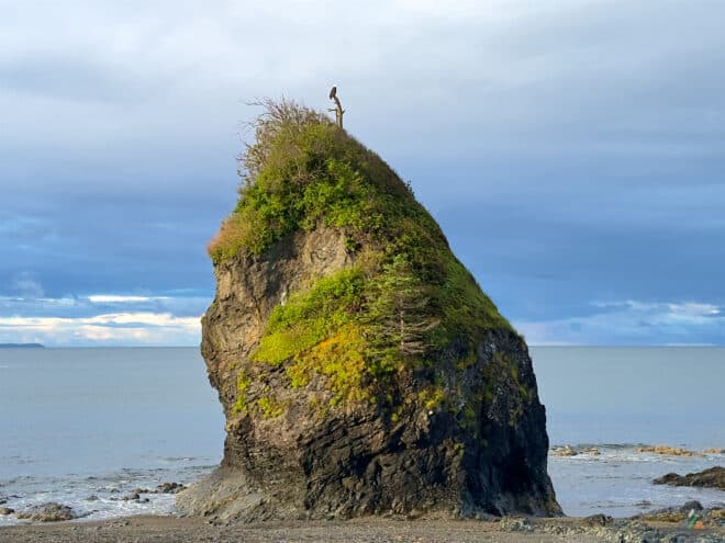
The camp on Sea Stack Beach is lovely because you are close to Yuquot (1 km) and past the final tidal lagoon obstacle of Tsa’tsil. It is a fine spot to rest and recover on the final evening. A sea stack and a good creek mark the spot. The creek may disappear under the sand before meeting the ocean. There is a nice camp spot high on the pebble beach between the logs. There is also a more established space with driftwood furniture at the edge of the forest, should you prefer.
Trip Reports
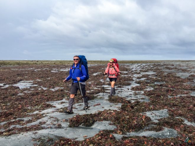
- Tongue Point to Yuquot – June 12-15, 2024
- Tongue Point to Yuquot – June 13-17, 2022
- Tongue Point to Yuquot – June 26-30, 2021
- Starfish Lagoon to Yuquot – September 4-8, 2018
- Starfish Lagoon to Yuquot – August 4-8, 2018
- Starfish Lagoon to Yuquot – July 7-11, 2018
- Starfish Lagoon to Yuquot – August 22-26, 2017
- Starfish Lagoon to Yuquot – June 25-29, 2016
Tongue Point to Yuquot – June 12-15, 2024
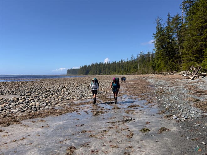
- Distance: 40 km
- Duration: 4 days
- Peak: 46 m
- Gain: 556 m
- Route: CalTopo
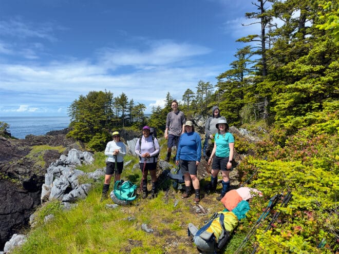
I guided six enthusiastic hikers on the wild and remote Nootka Trail on June 12-15. Our trip was originally planned to start on June 11 but we had a one day delay in Tahsis due to an unusually intense storm system. The rain delay was rewarded with a sunny start to the trip on June 12.
Day 1: Tongue Point to Calvin Falls
- Distance: 18.2 km
- Duration: 8 h 54 min
- Peak: 35 m
- Gain: 158 m
- Track: Suunto
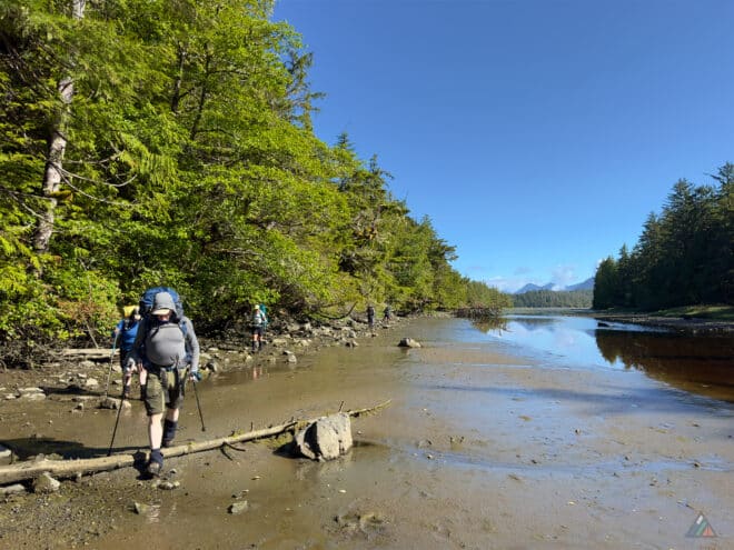
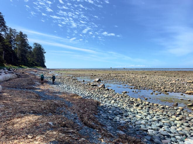
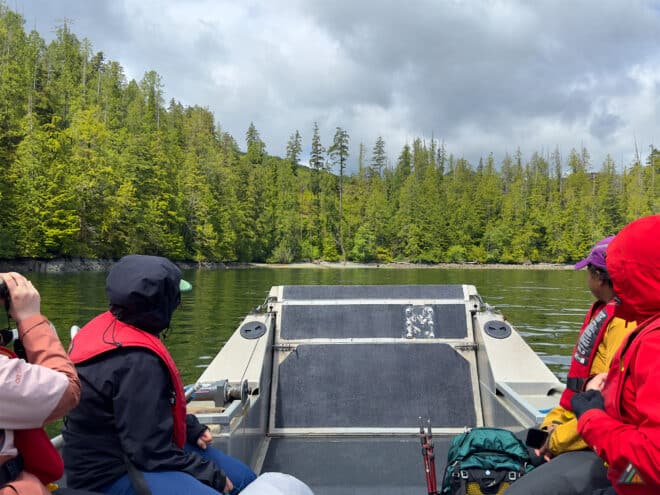
We sailed with Shorebird Expeditions from Tahsis to the northwest corner of Nootka Island, landing on the shoreline at Tongue Point. The water taxi is a great way to travel because a wildlife safari at sea level provides excellent wildlife viewing opportunities. On the way we saw many birds, including eagles, seagulls, cormorants, and ravens. Plus we were treated to several happy sea otters waving to us as we zoomed by their ocean homes. Tides were timed perfectly and we enjoyed an easy walk along the mud flats at the edge of Louie Lagoon. Entering into the rainforest and overland trails towards Third Beach, we encountered warm sunshine and drying route conditions. Many pocket beaches provided our first views towards the open Pacific Ocean and huge lingering swells from the previous storm. We found whale bones, wolf tracks, and many wildflowers including Nootka rose, thimbleberries, salmonberries, rice root, common silverweed, western lily of the valley, seaside pea, and wild strawberries. Arriving at Third Beach just before noon, we tried for the low tide route past the sea cave, but the swell was too big to safely pass. We continued overland and learned how to hurdle, limbo, crawl, and get muddy while navigating our way through the rough rainforest path and gnarly root systems. Popping out onto the beach and adjacent waterfall, we found that over two metres of sand had been excavated by the winter storms, completely changing the topography of this section. After negotiating one more inland rainforest section, we found ourselves back on the coastline that we would be hiking for the majority of the next two days. Coastal hiking, with a long uninterrupted sightline, is amazing for wildlife viewing. We could all scan ahead and hope for a wonderful surprise. Our team was rewarded with a pair of sea wolves viewed from a few hundred metres for almost 15 minutes. This wonderful sighting was capped off with howling and yipping, and the discovery of a third set of tiny wolf tracks, likely a new pup. We continued onwards by Skuna Bay and arrived at our target for the day, the most exquisite sandy beach with epic Calvin Falls flowing at full bore out to sea. We pitched camp and enjoyed a relaxing evening, watching the glorious sunset, magical twilight, and infinite stars light up the evening before dozing off to sleep in our cozy tents. Tomorrow morning we ford the creek!
Weather observations. Sky: clear, Precipitation: nil, Temperature: 7.9-21.2ºC, Humidity: 44.2-87.0%, Wind: calm-light NW, Pressure: 1023.9-1026.6 mb.
Day 2: Calvin Falls to Callicum Creek
- Distance: 14.9 km
- Duration: 7 h 33 min
- Peak: 46 m
- Gain: 87 m
- Track: Suunto
We successfully forded the roaring creek below Calvin Falls with some careful steps. The tide was low but the water was still above some of our knees, making for a challenging crossing. With pack straps undone we stabilized ourselves with a tight grip on our trekking poles. Once everyone was safely across, we dried our feet and got ready to hike the wild coastline for most of the day. The first beach section south of the falls is a beautiful kilometre of packed hard sand, making for a great sunrise warmup. We continued around the bay towards Bajo Creek where we completed an easier ford across the tops of stones. More challenging terrain presented itself with boulders, logs, gravel, and slippery sandstone shelves. Eventually we arrived at Bajo Point where we intercepted several large groups going in different directions. This school-group crowd with 27 people total was the busiest we had ever seen the trail. After a wave, we continued towards Beano Creek, trying to avoid the pea gravel by finding lines along the tidal shelf edges and forest driftwood. We arrived at Beano Creek and discovered the best spot to cross safely. This ford was easier than Calvin, but still deep enough to make it interesting. With more energy and light in the day, we continued to sparkling Callicum Creek. We were pleased for another beautiful night with camp all to ourselves.
Weather observations. Sky: clear, Precipitation: nil, Temperature: 6.9-22.2ºC, Humidity: 41.3-90.8%, Wind: calm-light NW, Pressure: 1018.7-1023.4 mb.
Day 3: Callicum Creek to Sea Stack Beach
- Distance: 10.8 km
- Duration: 7 h 41 min
- Peak: 46 m
- Gain: 289 m
- Track: Suunto
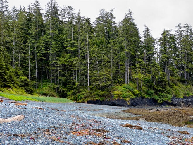
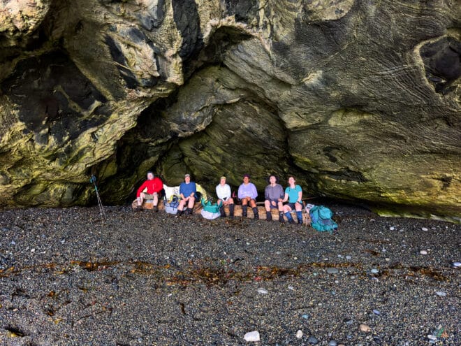
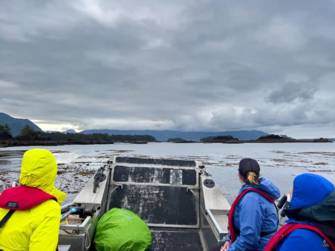
The tide was high this morning. We were forced to wait about 45 minutes to pass the tide obstacle south of camp. The low tide approach avoids a gnarly overland route that is very steep and bushy. After passing the cliffs and sea caves, we entered the rainforest and one of the many up and down inland sections. Just past the limestone cliff waterfall, we noticed a lone sea wolf saunter off behind a rock as we descended onto the beach. Unfortunately, this poor old wolf looked like he had an injured leg and limped off very slowly around the corner. We hoped by going overland we would pass the wolf, but he continued to move along the beach in front of us. We managed to pass the wolf at the next overland section and didn’t see him again but we wondered how he was going to fare with such a debilitating injury. The weather turned into a torrential downpour just as we arrived at a sea arch cave shelter. This feature offered the perfect spot for an extended break while we waited for the squall to pass. After more inland sections and pocket beaches, we arrived at the scenic limestone cliffs north of Maquinna Point. This spot has one of the best viewpoints along the entire trail, with a panorama of Nootka Island and Vancouver Island in the distance. After Maquinna Point, we enjoyed an upland bog with carnivorous sundews. We rounded the corner of another pocket beach and got our first glimpses of the finish line marked by the red-roofed Yuquot church and steeple. This sight motivated the group to push on past Sunrise Beach and all the way to Tsa’tsil Lagoon on a flooding tide. We were surprised with an easy shallow crossing on a sand bottom, significantly different than last year’s crossings. We finished the day at our final destination, Sea Stack Camp, only 1.5 kilometres from the end of the trail.
Weather observations. Sky: broken clouds-overcast, Precipitation: nil-heavy, Temperature: 8.8-19.9ºC, Humidity: 69.0-92.4%, Wind: calm-moderate SW, Pressure: 1017.2-1020.2 mb.
Day 4: Sea Stack Beach to Yuquot
- Distance: 1.4 km
- Duration: 0 h 21 min
- Peak: 25 m
- Gain: 13 m
- Track: Suunto
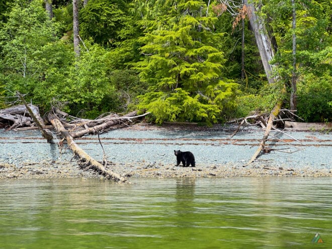
Our Shorebird Expeditions water taxi pickup was scheduled for noon. Being so close to the village, everyone could choose their own adventure: no alarms, no itinerary, and just a casual 1.5 kilometre stroll to the village. Some of us lingered at camp drinking tea and coffee as we soaked in the coastline, watching and listening to all sorts of wildlife. As always, the songbirds joined us for breakfast. An eagle perched high on the big sea stack, illuminated perfectly by the rising sun. Sea otters bobbed about offshore, entertaining us as we slowly got going. We eventually broke camp and enjoyed a relaxing village day: the old church, museum, lighthouse, and carving studio. We met the water taxi on the pier at 1130 h as a storm cloud rolled over us. The wildlife viewing continued and we enjoyed a wonderful marine safari, spotting a black bear feeding along the shoreline, passing several rafts of waving sea otters, and watching eagles soar overhead. The trip was capped off back at the Westview Marina & Lodge with another intense squall just to remind us that we were in the coastal temperate rainforest. We had a happy debrief under the marina shelter, said our goodbyes, and headed back to our respective destinations. Mission accomplished!
Weather observations. Sky: broken clouds-overcast, Precipitation: nil-moderate, Temperature: 7.8-14.8ºC, Humidity: 91.6-92.8%, Wind: calm-moderate S, Pressure: 1015.7-1017.1 mb.
Tongue Point to Yuquot – June 13-17, 2022
- Distance: 40 km
- Duration: 5 days
- Peak: 44 m
- Gain: 527 m
- Route: CalTopo
I guided a super keen group of seven participants on the Nootka Trail June 13-17. We experienced epic weather, viewed amazing wildlife, and enjoyed the camaraderie, safety, and logistical advantages of a professionally guided trip.
Day 1: Tongue Point to Third Beach
- Distance: 4.9 km
- Duration: 2 h 41 min
- Peak: 26 m
- Gain: 87 m
- Track: Suunto
We enjoyed a rare sunny morning in Tahsis and departed on the first Shorebird Expeditions sailing. We had glassy water all the way to Esperanza Inlet, weaving through the Nuchatlitz Islands and just clearing the sand bar at low tide. A short bumpy section across Nuchatlitz Inlet brought us to Tongue Point for a dry landing off the Shorebird ramp. We met a group of wildlife filmmakers at the Scout Camp. They informed us where several blinds were setup between Louie Lagoon and Second Beach. There was a rotting whale carcass surrounded by wolf tracks at Second Beach, where the wolves had been feeding on the dead meat. We arrived at Third Beach just in time for the first showers at noon. After setting up tents, everyone was keen to learn about rigging tarps with limited anchors. After such an early start, we had lots of relaxing with many afternoon naps!
Weather observations. Sky: clear-scattered clouds, Precipitation: nil, Temperature: 8.8-13.3ºC, Humidity: 70.0-92.5%, Wind: calm-light NW, Pressure: 1017.2-1021.3 mb.
Day 2: Third Beach to Calvin Falls
- Distance: 11.9 km
- Duration: 5 h 16 min
- Peak: 24 m
- Gain: 49 m
- Track: Suunto
We woke to clear skies and I shared the great forecast with the group. A high pressure ridge had settled in, bringing sunshine with a moderate NW breeze, and no precipitation. We got a decent 0815 h start and enjoyed the low tide route around the big sea cave from Third Beach to the waterfall beach. A larger group of ten young adults limited our chances of wildlife viewing. However, we saw lots of bear sign, including tracks and scat, strewn along the shoreline on approach to Skuna Bay. The smaller group behind us saw a black bear foraging in the kelp beds a couple hours later. We just made it past the Skuna tide obstacles with a 3.2 m water line and continued on under the spectacular sedimentary cliffs and beside two more waterfalls before arriving at the biggest waterfall at Calvin. The falls were roaring and we waited for the tide to recede before a fresh swim!
Weather observations. Sky: clear-few clouds, Precipitation: nil, Temperature: 7.5-15.2ºC, Humidity: 59.2-92.9%, Wind: calm-moderate NW, Pressure: 1021.5-1023.9 mb.
Day 3: Calvin Falls to Beano Creek
- Distance: 11.4 km
- Duration: 4 h 31 min
- Peak: 14 m
- Gain: 19 m
- Track: Suunto
Another dry start to the day. We were happy to pack moisture-free rain flies and tarps, making for an efficient departure. We successfully forded the Calvin crossing in knee-deep water. Trekking poles were helpful for extra stability in the swift current. The nice cameras were stowed in dry bags and backpack buckles were undone in case of a mishap. The hard sand beach section out of Calvin to Bajo Creek was spectacular during the negative low tide, exposing parts of the intertidal zone I’ve never seen before. Route conditions were excellent around Bajo Point. We saw two deer, the only mammals spotted today besides a mouse at camp. Apparently two wolves were spotted yesterday just NW of Skuna. The lack of mega fauna viewing has been replaced by lots of bird sightings. We arrived at Beano Creek in the early afternoon for freshwater swims and a campfire building workshop later that evening!
Weather observations. Sky: overcast-broken clouds, Precipitation: nil, Temperature: 9.4-15.9ºC, Humidity: 57.7-86.9%, Wind: calm-light N, Pressure: 1012.8-1021.8 mb.
Day 4: Beano Creek to Sunrise Beach
- Distance: 9.7 km
- Duration: 8 h 49 min
- Peak: 45 m
- Gain: 302 m
- Track: Suunto
The most challenging day so far included every type of coastal terrain. The 9 km journey had the longest inland rainforest sections and the most elevation changes. We departed Beano Camp at our usual time just after 0800 h and arrived at Sunrise camp almost nine hours later…1 kilometre per hour! Wildlife viewing included our first bear sightings of the trail. Three bears were spotted several hundred metres N of Beano Creek! After hearing other hikers’ experiences for the last few days, we were happy to see them. Bird viewing continued with lots of eagles and ravens, plus birds singing from early morning hours right to dusk.
Weather observations. Sky: overcast-broken clouds, Precipitation: nil, Temperature: 9.3-16.1ºC, Humidity: 69.9-89.5%, Wind: calm-light NW, Pressure: 1011.9-1014.6 mb.
Day 5: Sunrise Beach to Tahsis
- Distance: 4.1 km
- Duration: 2 h 14 min
- Peak: 25 m
- Gain: 70 m
- Track: Suunto
Sunrise Beach lived up to its name with beautiful early morning light on the valley bottom clouds. Whales were spotted for the first time at breakfast. A couple of lucky whale watchers got to see a full breach! We started our final hike out of Sunrise Camp at 0800 h and took the low tide route all the way around to Tsa’tsil Lagoon, making an easy ford across on coarse sand. The sun was blasting for our final pea gravel hike until we finally made it to the cool forest shade along trail to Yuquot village. We couldn’t pass by Jewitt Lake without stopping for a fresh water swim. We visited the sites in Yuquot and boarded our Shorebird water taxi at 1200 h for a spectacular ride up Tahsis Inlet. We were happy to spot another bear feeding on the intertidal buffet and a huge raft of sea otters before reaching our starting point from five days ago. An epic Nootka Trail trip with all the fixings, including the best weather this season, great wildlife viewing, and an excellent group of keen adventurers to share it with!
Weather observations. Sky: clear-scattered, Precipitation: nil, Temperature: 8.1-21.4ºC, Humidity: 54.0-91.9%, Wind: calm-light NW, Pressure: 1010.4-1014.0 mb.
Tongue Point to Yuquot – June 26-30, 2021
- Distance: 40 km
- Duration: 5 days
- Peak: 44 m
- Gain: 506 m
- Route: CalTopo
This trip was MB Guiding’s first adventure on the Nootka Trail in two years! The trail was closed to guided trips for all of 2020. Starting and finishing in Tahsis, we combined two Shorebird Expeditions water taxi rides with a five day hike to circumnavigate Nootka Island. We explored a new route from Tongue Point, eventually joining the main trail at Third beach and adding an extra 4 km to the trip.
Weather
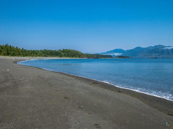
We started our trip during the peak of the June heat wave. The blazing heat made for a challenging hike. Temperatures ranged from the mid-teens to the high thirties. We enjoyed the refreshing water taxi ride on Day 1. Calvin Falls was a welcome reward and remedy after a hot Day 2 on the beach. Swimming was the first action upon arrival to camp. It was 32°C at sunset in the Beano Creek forest camp on Day 3. Marine layer rolled in off the ocean during the middle of night and cooled down camp by 15ºC. Day 4 delivered the most pleasant temperatures for our final hike to the Sea Stack Beach campsite.
- Day 1: 0850 h, Tahsis Dock. Elevation: 4 m, Sky: clear, Precipitation: nil, Temperature: 20.3ºC, Humidity: 71.6%, Wind: calm. 1630 h, Third Beach. Elevation: 6 m, Sky: clear, Precipitation: nil, Temperature:21.4ºC, Humidity: 62.7%, Wind: calm.
- Day 2: 0605 h, Third Beach. Elevation: 6 m, Sky: clear, Precipitation: nil, Temperature: 16.8ºC, Humidity: 86.4%, Wind: calm. 1430 h, Calvin Falls. Elevation: 6 m, Sky: clear, Precipitation: nil, Temperature: 29.4ºC, Humidity: 39.0%, Wind: light NW.
- Day 3: 0505 h, Calvin Falls. Elevation: 7 m, Sky: clear, Precipitation: nil, Temperature: 18.3ºC, Humidity: 71.6%, Wind: calm. 1435 h, Beano Creek. Elevation: 7 m, Sky: clear, Precipitation: nil, Temperature: 32.7ºC, Humidity: 42.1%, Wind: light NW.
- Day 4: 0525 h, Beano Creek. Elevation: 7 m, Sky: overcast, Precipitation: nil, Temperature: 15.3ºC, Humidity: 87.6%, Wind: light SE. 1935 h, Sea Stack Beach. Elevation: 6 m, Sky: clear, Precipitation: nil, Temperature: 19.8ºC, Humidity: 70.0%, Wind: light S.
- Day 5: 0500 h, Sea Stack Beach. Elevation: 6 m, Sky: broken clouds, Precipitation: nil, Temperature: 17.2ºC, Humidity: 77.2%, Wind: light SE.
Route
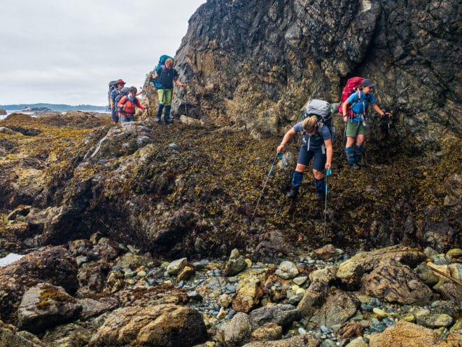
On Day 1 we enjoyed an awesome first voyage with Shorebird Expeditions. The water was glassy leaving Tahsis. We motored through Esperanza Inlet, around Nootka Island, and through the Nuchalitz Islands Provincial Park. Our boat passed several kayaks and a few lazy sea otters. Open water brought a 2 meter swell with cooling sprays over the bow! Our team arrived at Tongue Point and disembarked onto Nootka Island. The hike on mudflats was nice and gentle for our warm-up. On Day 2, we walked the low tide route from Third Beach and visited a massive sea cave. The inland sections were bone dry and easy going through the freshly brushed paths. Our group needed many shady rest breaks with fresh water refills and snacks. On arrival at Calvin Falls, we spotted several planes on the beach – a flying club from the mainland. After swimming, we created shady rest spots with tarp school and waited for heat to dissipate. On Day 3, we arrived at Beano Creek just after noon. The group maintained a solid pace by taking breaks in shady areas and at every water source. Staying well-hydrated (at camp and on the trail) and sun-protected were top priorities on this trip. Highlights of the day included visiting the Aass village site and a waterfall oasis. We enjoyed an enhanced interpretive tour with one of our trip participants, an archeologist who presented an annotated map of ancient sites. Day 4 was a big day of hiking, but temperatures had cooled. Our group started the morning with an easy ford of Beano Creek and low tide options. Easy trails, clear water refills in Callicum Creek, plus two more low tide routes made for pleasant travel. We arrived at the Tsa’tsil Lagoon crossing just in time with a 2.2 m tide. Everyone forded successfully in knee- to waist-deep water. We made our way to Sea Stack Beach, enjoying our second floatplane airshow from camp. Our final dinner was spent watching for whales. On Day 5, everyone was keen to swim in Jewitt Lake before an easy 1.2 km hike out to the dock and Shorebird Expeditions water taxi pickup.
- Day 1: Tongue Point to Third Beach. Distance: 5.51 km, Duration: 2:39’25, Ascent: 71 m, Ascent Time: 27’13.0, Descent: 62 m, Descent Time: 24’43.0. Suunto
- Day 2: Third Beach to Calvin Falls. Distance: 12.76 km, Duration: 5:09’19, Ascent: 42 m, Ascent Time: 14’06.0, Descent: 40 m, Descent Time: 16’05.0. Suunto
- Day 3: Calvin Falls to Beano Creek. Distance: 11.44 km, Duration: 4:24’59, Ascent: 3 m, Ascent Time: 2’29.0, Descent: 9 m, Descent Time: 4’565.0. Suunto
- Day 4: Beano Creek to Sea Stack Beach. Distance: 13.01 km, Duration: 7:51’59, Ascent: 289 m, Ascent Time: 1:45’55, Descent: 268 m, Descent Time: 1:30’15. Suunto
- Day 5: Sea Stack Beach to Yuquot. Distance: 1.83 km, Duration: 1:00’36, Ascent: 26 m, Ascent Time: 1’43.0, Descent: 16 m, Descent Time: 5’59.0. Suunto
Wildlife
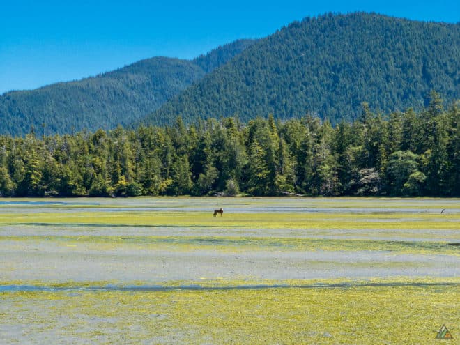
The best sighting off the trip was a pack of wolves in the first kilometre of Day 1. We could hear and see the wolves across the mud flats playing and chasing each other. We paused to investigate the Greek freighter wreck and saw wolves disappear into forest. One wolf showed himself as we were moved by, howling and barking at us. His friend across bay howled as we watched. After about 30 mins, he went and joined the rest of pack. We saw lots of bear and wolf sign the rest of the way to Third Beach. In the evening, we enjoyed viewing whale spouts. On Day 2, we heard an abundance of Swainson’s thrushes singing in the early morning light. They would continue to function as our natural alarm clock for the rest of the trip. We passed a baleen whale carcass just north of Skuna Creek. The animal was very smelly and we had to put our buffs over our mouths down wind. On Day 3, wildlife included the tail end of a wolf scurrying off into the forest just south of Bajo Creek, several eagles, an osprey, and rich intertidal zones. Upon arrival at Sea Stack Beach campsite, we saw our first black bear.
Hazards
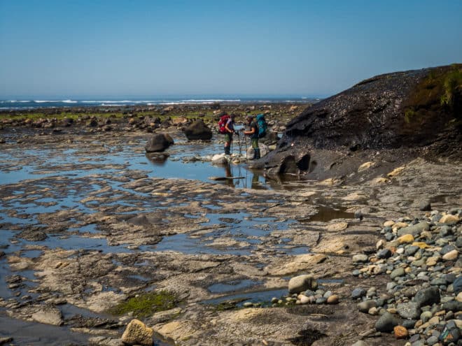
The main hazard of the trip was risk of heat exhaustion and dehydration due to the blazing heat. Frequent hydration, shade breaks, and slower pace were important strategies on the exposed beach sections. Swimming often was the cure at camp.
Starfish Lagoon to Yuquot – September 4-8, 2018
- Distance: 36.2 km
- Duration: 5 days
- Peak: 45 m
- Gain: 372 m
- Route: CalTopo
Here is our third and final adventure on the Nootka Trail in summer 2018! This trip was a special small group experience. Our team included a returning alumna local to Vancouver Island, a world travelling fellow from Switzerland, and myself as the guide. We staged our adventure at the Ridgeview Motor Inn (Gold River) and held our pre-trip meeting the evening before departure. We were pleased to all fit inside the Air Nootka Cessna 185 for a fast and light approach to Starfish Lagoon. Weather on this trip was our greatest friend and foe. We planned accordingly, watched the weather reports, and stayed ahead of the gale. Wildlife highlights included: bears, whales, sea lions, and abundant intertidal animals. We viewed more black bears than hikers over the entire 36 km route!
Day 1: Starfish Lagoon to Calvin Falls
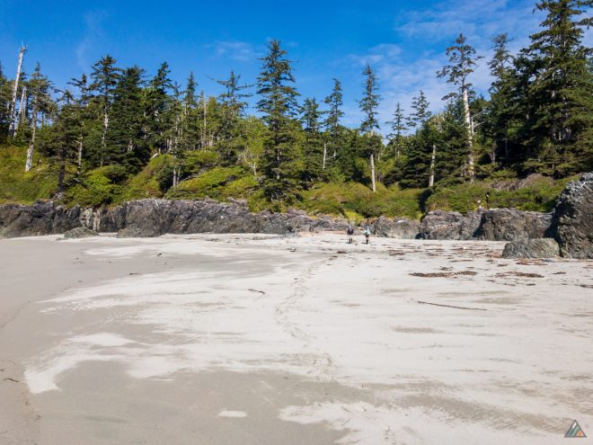
- Distance: 12.9 km
- Duration: 7 h 37 min
- Peak: 43 m
- Gain: 40 m
Our plan to stay ahead of the gale meant we had to hike all the way to Calvin Falls on our first day. Route conditions were excellent with hardly any mud. The route was even drier than our previous trip in August. We were happy to see five black bears just west of Skuna Creek. Two of these three bears were having a wrestling match as we passed by. We thought they might be siblings playing and practicing fighting. We had just viewed two other bigger bears not far away up the beach. We arrived to an empty campsite at Calvin Falls on Bajo Beach and enjoyed a beautiful evening all to ourselves.
Day 2: Calvin Falls to Beano Creek
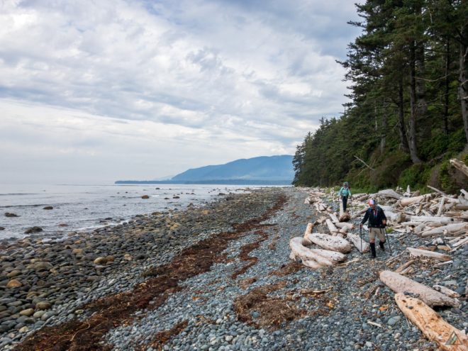
- Distance: 11 km
- Duration: 5 h 36 min
- Peak: 5 m
- Gain: 5 m
We got an early start out of camp under partly cloudy skies, following several sets of fresh wolf tracks along the beach. We arrived at Bajo Point mid-day to a colony of sea lions barking on rocks beside the sea stack. After an extended break on the logs, we explored the ancient village of Aass. We arrived at Beano Creek and viewed several humpback whales flapping their flippers and spy hopping. No other campers at Beano Creek!
Day 3: Beano Creek to Sunrise Beach
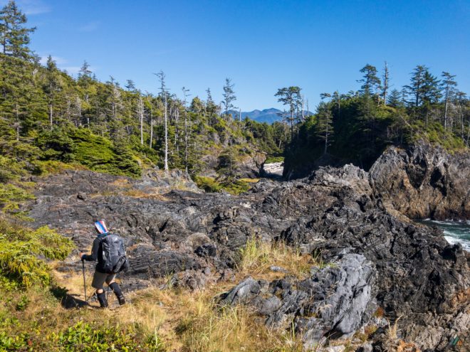
- Distance: 8.9 km
- Duration: 9 h 41 min
- Peak: 45 m
- Gain: 293 m
The hike from Beano to Sunrise is was a long, challenging day on varied terrain. We always stop and fill our bottles with the nice clear water at Callicum Creek. The next best water fill is at the unnamed lake northwest of Maquinna Point a few hours away. The rock formations adjacent to the Maquinna Point coastline were impressive. We arrived at Sunrise Beach to set up camp and the group tarp. Priority one was to prepare for the incoming weather. The rain started at 2200 h, finally breaking the summer drought. The plants of the arid overland bog section were no doubt happy for the moisture.
Day 4: Sunrise Beach to Yuquot
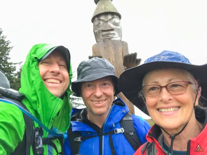
- Distance: 3.4 km
- Duration: 1 h 44 min
- Peak: 21 m
- Gain: 34 m
Our last few kilometres were especially slippery after the precipitation began. We forded Tsa’tsil Lagoon on a 1.5 m tide and walked through easily with boots and gaiters on. We were pleased to arrive in Yuquot one day ahead of schedule and negotiated a Yuquot Cabin for our final night. We attempted to check into cabin #6, however it was under construction. The stove and stove pipe were missing, leaving an open and leaking hole in the roof. We happily moved to cabin #3, which was also missing a stove but at least had a solid roof overhead. There was a lot of rain that night!
Day 5: Yuquot Village Day
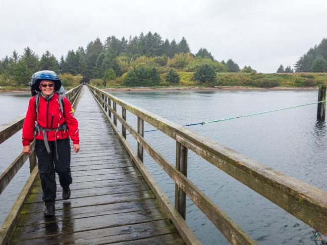
We woke in the cabin to dark grey skies and more precipitation but we were dry! The morning was spent organizing gear and exploring the village site, church, and museum. The Nootka Lighthouse was closed to the public while under construction. Many hiking parties arrived in the village. We had been a day ahead of them the entire trip. Our team heard several reports of a very wet evening out on the trail. We were again treated to more whales, and viewed a few humpbacks at the entrance to cove. Our final stage of the adventure was a ride with Get West Adventure Cruises on the refitted MV Uchuck III WW2 minesweeper. Hot soup and a homemade sandwich completed the trip!
Starfish Lagoon to Yuquot – August 4-8, 2018
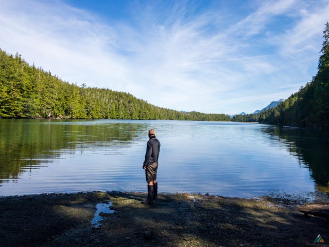
- Distance: 36.3 km
- Duration: 5 days
- Peak: 45 m
- Gain: 379 m
- Route: CalTopo
Our second trip of three in Summer 2018! This was a last minute custom trip, planned and executed in just one week. Weather was superb for all five days. We woke to marine fog each morning, and enjoyed hiking in the cool mist until it burned off in the afternoon. The lingering evening cloud wisps enhanced sunset colours. Crystal clear nights offered glittering star shows and Perseid meteor showers. Route conditions were very dry with minimal mud. Wildlife highlights included: black bears, wolves, sea otters, birds, and abundant intertidal life.
Day 1: Starfish Lagoon to Third Beach
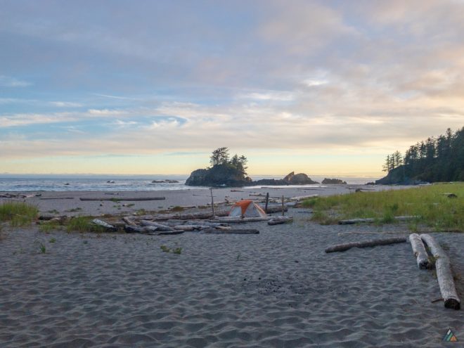
- Distance: 1 km
- Duration: 1 h 1 min
- Peak: 15 m
- Gain: 20 m
We met Scott and Greg at the Air Nootka dock and loaded our gear onto the Beaver at 0930 h. After a perfect landing in glassy water on Starfish Lagoon, we taxied to the shore and unloaded our gear onto the beach. The floatplane took off in a roar leaving the four of us on the beach in the wilderness silence. We adjusted our backpacks, and entered the rainforest route towards Third Beach. We spent the first hour of hiking on instruction, teaching terrain management, hazard awareness, and adjusting our equipment for the perfect fit. We arrived at Third Beach to glorious sunshine and shimmering white sand. As a bonus, there were no other campers! The rest of the afternoon was spent learning camping skills: setting up tents, throwing a food hang, rigging a kitchen tarp, and relaxing until dinner, sunset, and bed.
Day 2: Third Beach to Calvin Falls
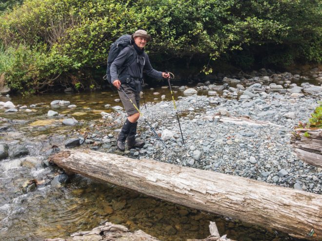
- Distance: 12 km
- Duration: 6 h 12 min
- Peak: 20 m
- Gain: 28 m
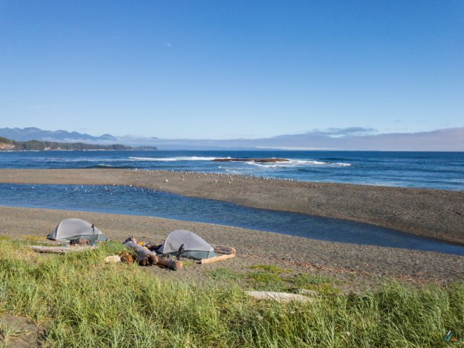
We woke to marine fog with eager guests already packed and ready to go! We enjoyed hot drinks and homemade granola during our morning meeting. We discussed our objectives, the weather forecast, tide charts, and route plan for the day. We were off the beach by 0800 h and back into the temperate rainforest jungle. Our first obstacle was a 20 m ascent up a steep hill to warm us up for the day ahead. The route was exceptionally dry through the forest. When we returned to the coastline, low flowing creeks were easily forded. The cool fog made for perfect hiking temperatures along the coastal sections. We arrived at Calvin Falls at 1412 h. The afternoon was spent swimming in the pool under the falls, exploring the expansive sand beach, identifying bear tracks, and relaxing until a sunset dinner and bed.
Day 3: Calvin Falls to Beano Creek
- Distance: 11 km
- Duration: 5 h 17 min
- Peak: 6 m
- Gain: 5 m
Awaking to another foggy morning, the guests were feeling a little lazier and less motivated to jump start into the day. It’s always hard to leave Calvin Falls! If you have the time, we recommend staying here two nights. After breakfast, foot care, and our morning meeting, we headed down the sand beach towards Beano Creek. This day was all coastal hiking, with minimal elevation gain. It can still be a challenge hiking through varied terrain of sand, pebbles, boulders, and along driftwood logs. We stopped at Bajo Point and explored the area while enjoying an extended mid day break. We spotted a black bear feeding on washed up kelp beds from 300 m. The bear was downwind of us and caught our scent. He sauntered up onto the logs and into the grasses, eventually disappearing into the bushes. We arrived at Beano Creek at 1303, with plenty of time to enjoy bluebird skies, and laze the afternoon away. The guests enjoyed many siestas!
Day 4: Beano Creek to Sunrise Beach
- Distance: 8.9 km
- Duration: 8 h 51 min
- Peak: 45 m
- Gain: 290 m
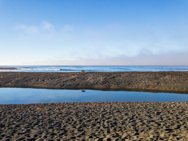
This morning was fog free and sunny! We are always aware that we share the trail with many other creatures. During our breakfast coffee, we were pleasantly surprised and treated to a sea wolf walking across the gravel bar in front of our camp. This perfect viewing opportunity resulted in many photos. We packed up our camp and began the big fourth day. Starting with pea gravel, we were also challenged by many ups and downs, in and out of the forest and pocket beaches around Maquinna Point. Yuquot started to come into view. The group was tired and happy to stop and setup camp at Sunrise Beach. More glorious sunset colours painted the sky during dinner and the ocean lulled us to sleep on our final night.
Day 5: Sunrise Beach to Yuquot
- Distance: 3.4 km
- Duration: 1 h 30 min
- Peak: 22 m
- Gain: 36 m
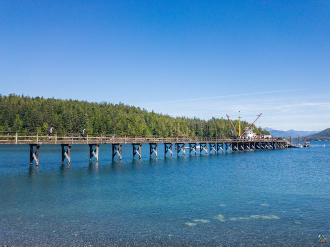
On our final day we awoke to a spectacular sunrise, and enjoyed views across Nootka Sound towards the Vancouver Island Ranges. We departed camp early to make the easy ford at the mouth of Tsa’tsil Lagoon. We arrived in Yuquot with plenty of time to explore the village, swim in Jewitt Lake, and rest our tired legs before boarding the MV Uchuck III. The snack bar opened when we departed from the dock, and we were first in line. The team reminisced about the hiking challenges and lucky wildlife sightings. We reviewed our trip over hot soup, sandwiches, chips and pop!
Starfish Lagoon to Yuquot – July 7-11, 2018
- Distance: 36.4 km
- Duration: 5 days
- Peak: 44 m
- Gain: 490 m
- Route: CalTopo
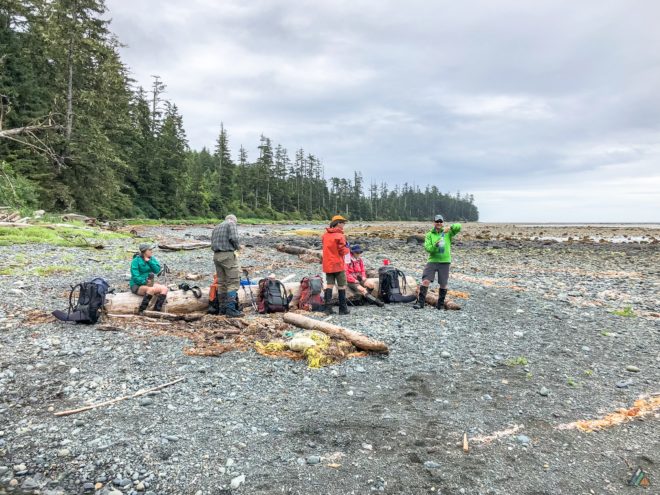
If the purpose of our trip was to see incredible wildlife, Nootka Trail delivered on the first day! We had excellent weather, with only a few scattered showers. The trail was quiet and tranquil. We encountered clusters of humans only at camps and popular break spots. Creek levels were higher than past trips due to recent rainfall. Birds dominated the animal scene, but we were lucky to have a special mammal viewing on our first night. We also encountered an amazing array of natural beach artifacts. Every year, every season, and every trip is different from the last. Nootka is a favourite for us, and July 2018 was no exception. With a team that felt like a group of friends right from the start, we had a relaxing experience on Nootka Island.
Day 1: Starfish Lagoon to Skuna Bay
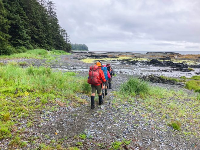
- Distance: 8.2 km
- Duration: 8 h 14 min
- Peak: 42 m
- Gain: 100 m
We awakened to a cloudy morning, but were still on schedule for our 0800 h Air Nootka flight. At 0830 h, pilot Scott executed one of his smooth, signature landings in Starfish Lagoon. Bat stars rested in the shallows, and a giant moon jelly floated by. Everyone changed into boots and discussed the terrain hazards and wildlife. We left Starfish Lagoon at 0907 h and crawled through the muddy jungle toward Third Beach. The creek at Third Beach was at high flow and winter storms had eroded the sand bar. Because of the drizzle, we decided to hike on to Skuna Bay. The rain stopped after noon and we enjoyed the open beach sections. A bear skull and a whale skeleton were biological artifacts we encountered along the way. The whale bones bleached in the sun and the great skull was separate from the body. Bird sounds of the day included hermit thrushes, Pacific wrens, ravens, and small shore birds. Mammals were elusive, but we saw a fisher at a break spot and a black bear at Skuna Bay Camp! We had a perfect viewing from a safe distance. The bear browsed for greens at the interface between beach and forest. We set up camp while he continued with his feeding behaviours. Before we cooked dinner, we talked to him and told him we would be staying the night. He looked at us for a few seconds, then walked into the bushes. We did not see him again. Only a flock of shore birds and bald eagles remained. Notable creek crossings of the day included an unnamed creek near the 5 km mark (boots off) and wide Skuna Creek. We fell asleep to the sounds of the waves, tides, fog horn, and creek.
Day 2: Skuna Bay to Calvin Falls
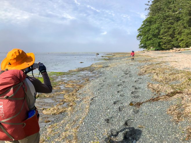
- Distance: 4.4 km
- Duration: 1 h 20 min
- Peak: 7 m
- Gain: 17 m
An easy coastal hike was on the itinerary! We travelled 4 km between Skuna Bay and Calvin Falls under intermittent sun and fog. Hermit thrushes were dominant singers in the forest and robins hunted the beach. We conquered two tidal obstacles: a sandstone shelf in Skuna Bay and cold Calvin Creek. A short day with beautiful weather provided an opportunity to enjoy camp. We set up tents on the quiet south side of the creek, away from the base of the falls. Using driftwood and a big tarp, Mike crafted a comfortable living room and kitchen. We weren’t moving much, but we were still hungry and took all our snack breaks as planned. Muscle rest and recovery was easy in this spectacular west coast spot. We even had time to practice some wilderness navigation with a map and compass. The best wildlife viewing of the day was a hunting bald eagle pair. Their home was a nest in a tall tree at the forest-beach boundary. As we ate dinner, one of the eagles swooped into the mouth of Calvin Creek and plucked a flounder from the shallow water. The poor fish wriggled in terror as he became airborne. We could imagine his surprise at seeing a blurry ocean from above with his underwater eyes. As the eagle turned back to the nest, his partner dropped from the air and caught a second flounder! Two eagles, two flying flounders. After such a lovely nature show, the sun dropped below the fog and clouds for an epic sunset. Later, a crystal clear night revealed billions of stars, a crescent moon, and orange Mars.
Day 3: Calvin Falls to Beano Creek
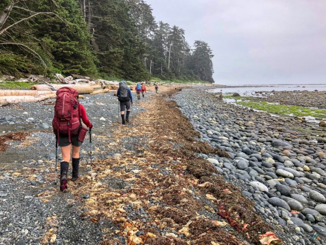
- Distance: 10.8 km
- Duration: 4 h 28 min
- Peak: 12 m
- Gain: 25 m
Hermit thrushes, robins, song sparrows, and ocean waves served as our alarm clock. After a nice warm up on the flat sand south of Calvin Falls, the terrain got tougher. Sand gave way to logs, boulders, and tidal shelves. The day was foggy, but cooler temperatures made for easier hiking in the pea gravel. Bajo Point with its famous sea stack was our mid-day break spot. Ravens and crows enjoyed the point with us, arguing with each other in the trees. Mustard flowers in purple, white, and yellow grew in a thick band behind the logs. The flowers continued south towards Beano, a soft border between the beach and forest. We didn’t see any bears, but observed their semi-circular pebble digs south of Bajo. Our best mammal sighting of the day was a sea otter floating in a kelp forest, easy to spot from the trail. We arrived at Beano Creek with plenty of time to enjoy camp. The beach north of Beano harboured lots of biological artifacts. The fused plates of sea urchin skeletons with bumps where spines once connected. By-the-wind sailor (Velella velella) jellyfish bodies, bleached and transparent. Vertebral bones of large, unidentified mammals. Blue mussel shells tangled with rock weed and pebbles. Giant barnacle shells made of calcite, the most stable form of calcium carbonate. Life and death on the beach, with the constant recycling of carbon, minerals, and atoms back to the sea. Beano Creek flowed strong below our camp. We collected fresh water before the tide flooded back in. At dinner, two ducklings swam against the rapids up the creek. Black oystercatchers enjoyed a bird bath where the salt and fresh water mixed. Our avian friends shared their home with us as we settled in for the night.
Day 4: Beano Creek to Sea Stack Beach
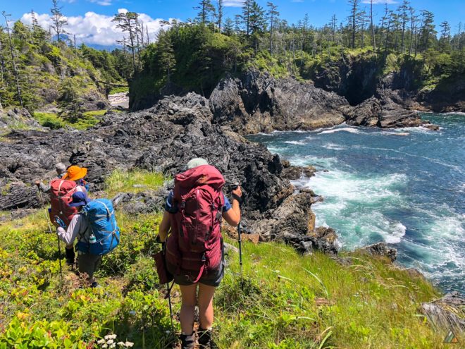
- Distance: 11.3 km
- Duration: 9 h 44 min
- Peak: 44 m
- Gain: 321 m
The section between Beano Creek and Sea Stack Beach is always a guaranteed challenge. The horizontal distance is only 11 km, but the varied beach and forest terrain is strenuous. The gravel bar over Beano Creek was not intact this year, so we started the day’s journey with a ford through the cold water. Next we hiked the “beans” and entered the forest for the first of many inland sections. The sun was hot as we climbed in and out, over and down, and through the thick green salal bushes. Most of the time, we couldn’t see our own feet! The best water on Nootka Island flows from crystal clear Callicum Creek. A favourite spot for a quick break was on top of the windy limestone cliffs. We watched black oystercatchers give alarm calls as an eagle glided above. Other geologic features in this section included sea caves with “windows” and lenticular sandstone. The upland bog captured a few of us in the mud pits, while the last few pocket beaches tested our remaining strength. Some of the overland root scrambles were steep and muddy. We had two camping options once we emerged from the forest: Sunset Beach or Sea Stack Beach (our names). The team opted to hike a bit further to Sea Stack, putting the tidal problem of Tsa’tsil Lagoon behind us. We set up tents at the fireweed border below the path to Yuquot and enjoyed another colourful sunset. Some of us jumped into the ocean to wash off the mud before the air cooled. Sea otters joined us for dinner, their brown heads bobbing among the kelp while hunting.
Day 5: Sea Stack Beach to Yuquot
- Distance: 1.7 km
- Duration: 0 h 50 min
- Peak: 16 m
- Gain: 27 m
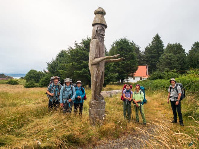
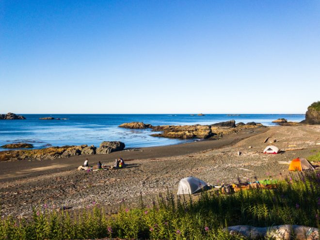
Camping at Sea Stack Beach allowed us to enjoy a slow breakfast and extra coffee on our final day. The sun rose yellow and warm and dried our tents. We organized food bags and traded chocolate with tea leftovers. After breakfast, everyone split up to enjoy some personal time doing preferred activities. Some folks took photos of wildlife, scenery, and tide pool creatures. The nearby beach rocks were thick with green sea anemones and purple sea stars. Others headed to Aa-aak-quaksius Lake (Jewitt Lake) for a relaxing fresh water swim. And a few opted to enjoy our sunny camp a little longer. We only had a short hike from Sea Stack Beach to Yuquot and the Welcome Figure at the end of Nootka Trail. Yuquot means “where the wind blows in all directions.” It was the site of first contact between Europeans and the Nuu-chah-nulth people. After exploring the Nootka Lighthouse and the museum, our group met to board the MV Uchuck III. We shared the boat with an exuberant group of day-tourists. The Uchuck’s famous homemade chili sold out within minutes. Our sky was bluebird for the two-hour journey back to Gold River. We sat on the breezy upper deck back benches, joking and remembering the details of our fantastic trip.
Starfish Lagoon to Yuquot – August 22-26, 2017
- Distance: 37 km
- Duration: 5 days
- Peak: 34 m
- Gain: 500 m
- Route: CalTopo
The Nootka Island Trail is always a rewarding coastal trip. This year was no exception. We had the pleasure of sharing the trail with a previous guest who had joined us last summer on the Augerpoint Traverse. We also had the honour of helping a fellow create a special birthday trip for his wife. Everyone was well-prepared and excited for the backpacking challenge. Over five days, we encountered few other humans. We were lucky to have excellent weather and frequent wildlife sightings. One creature in particular found our group appealing. He would be our friend over many kilometres.
Day 1: Starfish Lagoon to Third Beach
- Distance: 1 km
- Duration: 1 hr 0 min
- Peak: 32 m
- Gain: 41 m
Fog delayed our early morning departure from the Air Nootka terminal. We didn’t mind, as the extra time gave us a chance to get to know each other. Our pilot flew over the entire Nootka Trail route, giving us a preview of the week to come. Massive bands of golden kelp forest were visible from the air. Starfish Lagoon contained colourful bat stars as always. We changed out of our water shoes and into our hiking boots on the tiny wet beach. Before entering the rain forest, we discussed techniques for moving in coastal terrain. It was a short but careful hike to foggy Third Beach through the wet logs and mud. We had the huge sandy camp all to ourselves. Everyone found a private spot to pitch their tent. A decent driftwood kitchen had been set up, complete with a raised flat counter and stove surface. We enjoyed a serene evening for our first night.
Day 2: Third Beach to Calvin Falls
- Distance: 12 km
- Duration: 7 h 42 min
- Peak: 27 m
- Gain: 67 m
We started the morning with some light rain, but it was enough to slow our departure. By the time we got underway, the rain stopped and we were warm. The section to Calvin Falls was a mixture of dense rain forest and all kinds of beach terrain. We encountered a black bear foraging in the thick mounds of bleached eelgrass. On approach to Skuna Bay, we glimpsed a sea wolf before he disappeared into the trees. While we waited to clear the rocky Skuna tidal obstacle, a large sea otter floated by. Forced breaks often result in excellent wildlife sightings! This was the first time any of us had seen a sea otter in BC waters. These creatures help maintain kelp forests by feeding on sea urchins. Sea otters are true marine mammals, as they spend their entire lives in the ocean. We saw our first human hikers at Calvin Falls Camp when we arrived. They waved to us from the eastern shore. We opted to camp on the west side and cross the creek the next morning. Even though the afternoon was chilly, we all swam in the Calvin Falls pool before dinner.
Day 3: Calvin Falls to Beano Creek
- Distance: 11 km
- Duration: 6 h 36 min
- Peak: 5 m
- Gain: 27 m
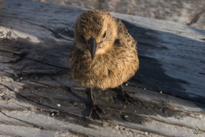
As we packed for the day, a little bird joined us! He was fearless and hopped onto our gear all morning. We didn’t know what species he was, but he acted like a curious baby. Later, a biologist friend helped identify him as a juvenile brown-headed cowbird. He flew across Calvin Creek to visit the other campers too. We said goodbye to him and enjoyed a shady morning of hiking over boulders that looked like dinosaur eggs. Bajo Point was our main break spot to rest and explore the historic First Nations village in the forest. The fin of a porpoise sliced the surface beyond the inner reef. As we ate snacks, the little cowbird dropped onto the surrounding logs! He had followed the other group of hikers all the way from Calvin Falls. He rode our shoulders and trekking poles as we turned into the hot sun for the march to Beano. The pea gravel experience was reasonable. Wet sand packed into the gravel this season, creating a more solid surface. We had good water sources and noticed abundant trout. After arriving at Beano Creek, the cowbird surfaced again! The little avian had followed us the entire 11 km. We never saw him again after Beano.
Day 4: Beano Creek to Sea Stack Beach
- Distance: 11 km
- Duration: 11 h 19 min
- Peak: 34 m
- Gain: 336 m
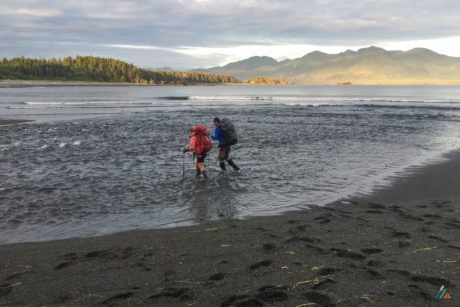
The gravel bar over Beano Creek was intact. The winter storm season had pushed the “beans” around to our advantage. We hiked over this natural bridge as creek water flowed under our feet and trickled out to sea. Our day included a mix of beach and forest terrain. Some of the overland areas had ropes to assist hikers. Other sections required us to scramble down tangles of roots. We met another group of hikers at Callicum Creek, famous for it’s excellent water and strong flow. The limestone cliffs were a highlight, as was the Maquinna Point landmark. We could now see Vancouver Island in plain view. We arrived at the Tsa’tsil tidal lagoon at 1900 h. The tide was too high to ford this obstacle. We pooled our remaining water and boiled up a picnic dinner. We crossed Tsa’tsil an hour later and rolled into Sea Stack Camp at around 2030 h. The sun was almost down, so we set up without hesitation. We collected water in the dark, which is always an adventure at the end of a long day. Some of us had tea under the stars, while others crashed in their sleeping bags. We knew that we could sleep-in and take our time the next morning. Luxury!
Day 5: Sea Stack Beach to Yuquot
- Distance: 2 km
- Duration: 1 h 30 min
- Peak: 18 m
- Gain: 29 m
Then final hike to Yuquot was only 2 km! The group slept in and enjoyed a relaxed breakfast and camp breakdown. We split off into smaller groups so people had the chance to explore Yuquot at their own pace and desire. Some of us hiked to Yuquot earlier and swam in the cold cove near the Nootka Island Light Station. Others took time on Sea Stack Beach to absorb the last few hours of solitude before our inevitable rendezvous with day tourists in Yuquot. We had fun aboard the MV Uchuck back to Gold River. We sat at tables in the gallery area and ate from the little onboard restaurant. We reminisced about the journey, and also learned even more about each other. Our group was fantastic; we couldn’t have had a better trip. Excellent weather, lovely company, surprising wildlife, and a wilderness trail that inspired us. We can’t wait to return to Nootka Island next year and see how the winter storms have rearranged the pebbles! We hope our bird friend continues to thrive wherever he is.
Starfish Lagoon to Yuquot – June 25-29, 2016
- Distance: 41 km
- Duration: 5 days
- Peak: 34 m
- Gain: 664 m
- Route: CalTopo
Our five-day trek along the rugged Nootka Trail, also known as the Nootka Island Trail, was real coastal magic and exceeded all expectations. Excellent weather, unexpected seclusion, and the culmination of a three-year shared dream made for a spectacular and satisfying week of backpacking. We took our time to watch wildlife, listen to birds, take photos, practice wilderness camp skills, read, swim, and do nothing at all. The trail is on Nootka Island, a 534 square kilometre island separated from Vancouver Island by the complex inlets of Nootka Sound. Getting there is an adventure in itself, as Nootka is only accessible by floatplane, boat, or water taxi. The trail is also not within a provincial or national park. Instead, most of the route falls within a Vancouver Island Special Management Zone. Some sections pass through land that belongs to the Mowachaht/Muchalat First Nations. Although the journey shares many similarities with the more popular West Coast Trail and North Coast Trail, the Nootka Trail has its own special feeling. We hope that one day the trail achieves proper protection within a park system.
Day 1: Starfish Lagoon to Third Beach
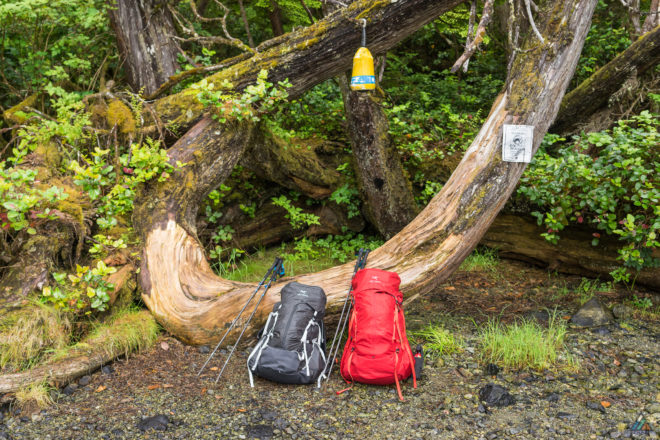
“Will you be ready in 10 minutes?” Scott, our Nootka Air pilot, was the first person we saw that morning…and the only person we would see for the next five days. He was surprised that we were ready to fly, not knowing we spent the previous night in Gold River organizing gear and food. Our packs were full, we wore our water shoes and shorts, and the bear spray plus camp fuel was in a separate bag for stowing. Scott loaded our packs onto the plane and expressed excitement for our adventure ahead. Pilots are fascinating people. They are so passionate and contemplative about the mechanics, feelings, and experience of flight. Scott flew us to Starfish Lagoon in the Cessna 185, giving us a fantastic preview of the entire Nootka Trail. The green tidal shelves, massive brown bull kelp beds in turquoise water, and the vast expanse of the Bajo Reef area made a big impression from the sky. It was a treat to see the Nootka wilderness as a raven does. Before descending into Starfish Lagoon, Scott banked right for a thrilling view of the ship wreck near Tongue Point. The tides would not be in our favour to see the wreck during our planned day-hike later, so we were grateful for the fly-by. After a perfect landing in glassy Starfish Lagoon, we disembarked into shin-deep water and ferried our packs to a small wet beach. True to the name, blue bat stars shimmered beneath the rippled surface. Once we helped push the plane off the gravel, and the noise of the engines died away, we felt the remoteness of the place.
Our forest friend, the ever-present Pacific wren, sang from the bushes with his irregular, staccato song. Otherwise the air was still and grey, a light rain just beginning to fall. We put on rain jackets and switched into hiking boots for the short forest traverse to Third Beach. The rugged rainforest hiking started immediately as we climbed over a log about 10 seconds in. The rain fell harder as we slipped and slid over muddy roots, blowdowns, and creek beds. After about an hour, the forest opened up and our big creek spilled onto glorious sandy Third Beach. There was a large clearing close to the creek that looked popular. We were told a group of five was going to be dropped off in the afternoon, so we hiked west to a smaller site near the sea stack. Because it was still morning, we took our time to set up a really nice tarp and food hang.
We grabbed our essentials after lunch and headed northwest for a day-hike towards Louie Bay. The sun was finally out and warmed us as we explored pocket beaches, sea caves, surge channels, meadows with wildflowers, overgrown rainforest, and algae-filled ponds. We made it to the flooded tidal creek south of Louie Bay before retracing our steps. This side-trip is definitely worth the time if you arrive at Third Beach early, or if you have extra days in your itinerary to play with. As soon as we returned to camp, we jumped into the blue-green ocean for a swim before the rest of the hikers appeared. There was more wind, but still sunny and dry. As we changed into warm camp clothes and rehydrated our chili, we waited for the sounds of aircraft that never came. Instead, all we heard were robins in the forest behind us. As night fell, we knew there would be no plane coming. That meant we would be hiking alone in wilderness solitude unless we caught up to another group. It was a lucky break.
Day 2: Third Beach to Calvin Falls
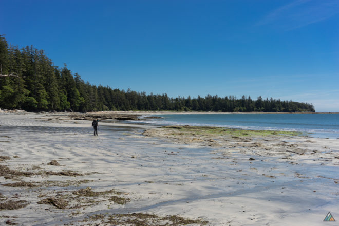
Today marked the section that would take us to the best campsite on the Nootka Trail. Most of the day involved hiking on beach terrain, with a few sections in the rainforest. The longest overland section was a true jungle, with thick, overgrown salal and a dark, “Mirkwoodian” feel. The morning was cool and foggy, but it didn’t take long for the sun to burn it away. We took our first break on Mussel Beach Point, which is appropriately named for the piles of white-purple shells everywhere. It was a good place to practice coastal navigation, as we could see several points to the northwest and hills towards the east. The beach walking was very good because the tide was low and we could choose the best path. In the intertidal zone, the rocky areas were alive with animals. We took care to place our feet on durable, bare rock surfaces. Hundreds of tiny crabs scampered out of our way. Some would stop and raise their claws for a fight. It must have been frightening for the brave little creatures to have giants walk through their homes. There was lots of fresh water along this section in the form of small waterfalls or creeks. Air Nootka flew by twice over the course of the day, presumably dropping off more hikers in Starfish Lagoon.
Once we saw a moving creature about 300 m from our resting spot on a rocky headland. He was foraging in the bleached eelgrass near the border of the tidal shelf. We couldn’t tell if he was a black bear or a dark sea wolf because he looked so small. Our eyes scanned the shoreline for others, but there were none. We watched for a few minutes, then descended from our rock to the beach. Cautiously and slowly, we hiked along the shore. Once the tidal shelf emerged, we headed out into the middle to give the animal a very wide berth. As we got closer, we saw that he was a small black bear. Not a cub, but not that old either. His fur looked a little fluffy still. There was no evidence of other bears near him. As we were passing him way out on the shelf, he caught sight of us. He looked at us curiously for about five seconds, then resumed foraging in the seaweed. After a few more seconds, he changed his mind and bounded up into the forest. We also saw a whale today, and it would be the only one on the trail. The amazing Skuna Bay offered perfect beach hiking, with packed wet sand curving for about 1 km. We easily solved the cliff cut-off tidal problem and took our lunch break at the east end of the bay.
The grand finale of the day was the sweet approach to Calvin Falls along gorgeous Calvin Beach. From the west end, a big notch in the trees gave us a clue to where Calvin Creek might be. When we arrived at camp, we were the only humans there. Calvin Creek was low, but the tide was rising, so we crossed right away and set up camp on the south side. We didn’t waste any more time, and rushed into the deep green pool beneath breathtaking Calvin Falls. It was the perfect swimming spot as the bottom was sandy and the water fresh. We stayed in for a long time, in and out, getting hot on the sand then back in for a dip. Eventually, the sun sank a little lower, and we put on warm clothes to enjoy homemade split pea soup. The creek swelled and backwashed with the evening tide, becoming deeper by the minute. We took a sunset walk after dinner to stretch and take pictures. These are such special west coast zones, the soft, long sandy beaches bordered by quiet green forest, the evening air cool and misty.
Day 3: Calvin Falls to Beano Creek
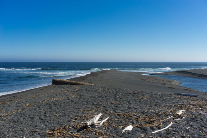
The morning was foggy and cool, but still beautiful and peaceful. Most of our day was spent hiking on beach terrain. As we traveled almost directly south, we were grateful for the shade from the rising sun. We knew there was a strenuous day ahead, so we did our best to find flow and efficient lines for moving along coastal features. As much as we could, we hiked on the giant logs that were bleached and dry. Knowing that anytime a log could move or shift beneath our weight kept us stepping lightly. Our route was bordered by a large, open Sitka spruce forest. When the logs were no longer an option, we stepped carefully over boulders and along tidal shelves. All surfaces were slick and green with algae. Periodically, the boulders would abruptly end and the only options were tidal shelves or endless pea gravel. The reef of Bajo Point seemed to spread forever, and we remembered seeing it from the air. Waves broke many kilometers off-shore, showing the huge boundary of this feature. A sea stack marked the actual point. We visited the historic First Nations territory of Aass and saw the remnants of ancient longhouses. It was here we heard our first raven of the trip.
As we rounded the point, the sun baked down on us. Pea gravel seemed the only feasible option as we slogged along for at least 5 km, hopping on logs where possible. It was a tiring stretch, and we took many breaks lying with our heads down-slope and our feet feet propped up on a log. The ospreys and eagles watched us from their trees, pea gravel posing no problem for creatures of the sky. Just to make sure we had enough pea gravel, the approach to Beano Creek Camp was up a small mountain of it. Pushed and moved around by waves and storms, pebbles fell and poured all around our boots as we sank with each step. After surveying the deserted site, we slid back down the bank to cross Beano Creek while the tide was low. Then we climbed back up the “beans” in our Crocs.
A note about our ugly, yellow, Crocs: they are death traps on flat, wet, slippery surfaces, but excellent on flat sand or dry logs. They are also lightweight, which make them reasonable to pack for coastal backpacking trips. Plus they feel pleasant and squishy on the feet after a day in the boots. We used our Crocs for Starfish Lagoon, creek crossings, and as camp shoes for the two previous sandy sites. They were ineffective in the pea gravel at Beano Creek due to the drainage holes on the top and around the edge of the shoes. Taking even one step flooded the Crocs with hundreds of small pebbles that got between the toes and under the arches, making walking painful and ridiculous. Yes, this really is as silly as is sounds. We use prescription foot-beds, okay? Our paws are delicate. Desperate for a fix, we found duct tape and used it to plug up the largest holes. It worked! Now we could run up and down the pebble hills of Beano and stop to empty out our shoes every tenth step instead of every single step. It made a huge difference. The evening was spent swimming, resting, and watching the tide flood Beano Creek. Pea gravel may be hard to hike in, but it makes for a nice clean camp. There is nothing better than sitting on the warm pebbles at camp eating tasty food.
Day 4: Beano Creek to Yuquot Beach
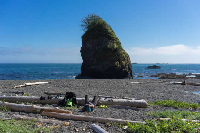
Today was our longest and most difficult day of hiking. We moved in and out of the rugged rainforest and small pocket beaches. The tides were falling as we started and we were able to walk below the cliffs at the east end of Beano Beach and tackle the tidal gully. The rocks below the gully were greasy, making it a challenge to take our packs off and stow our poles. The overland trail is available if the tide has flooded this zone. Along the way, we saw sea caves, huge cedars, meadows with flowers, arches, and limestone cliffs. We took the side-trip to Maquinna Point and saw our first glimpse of human activity since the floatplanes: pods of fishing boats. Just past the point, we navigated through a spongy bog with knee-deep mud. Hesquiat Peninsula on Vancouver Island grew larger in our sights.
At lunch, we rummaged through our dwindling food bags to take inventory. The candy that was supposed to last five days was gone on day two. The delicious vegan cheese and crackers were long gobbled. All we had left was a final dinner of chili, one bar of chocolate, and one protein bar each for the next day. Sugar cravings notwithstanding, we had calculated our nutritional needs accurately. We didn’t stay too long at lunch, as we had our final tide problem to solve. The last few pocket beaches had rope-assisted overland scrambles. These sections we fun and challenging, requiring us to turn around to face the slope while climbing down backwards. When we finally arrived at the tidal lagoon of Tsa’tsil, it was fordable but the tide was rising. We decided not to fiddle around, and waded straight on through with our muddy pants and hiking boots. Some of the mud on our legs flowed out to sea. One last stretch of dreaded pea gravel spanned before us, but we could see where we wanted to camp. The fog, which had made for cooler hiking in day, finally burned off as we hiked Yuquot Beach. Camp was made on a clean hill of pebbles, adjacent to a sea stack and a creek that disappeared into the sand before it met the ocean. We could see the trailhead from where we sat. As we unloaded our gear, the area was filled with noisy black oystercatchers chasing each other around the pebble mounds. We saved the heartiest dinner for the end, and enjoyed it with a final bar of chocolate.
Day 5: Yuquot Beach to Yuquot
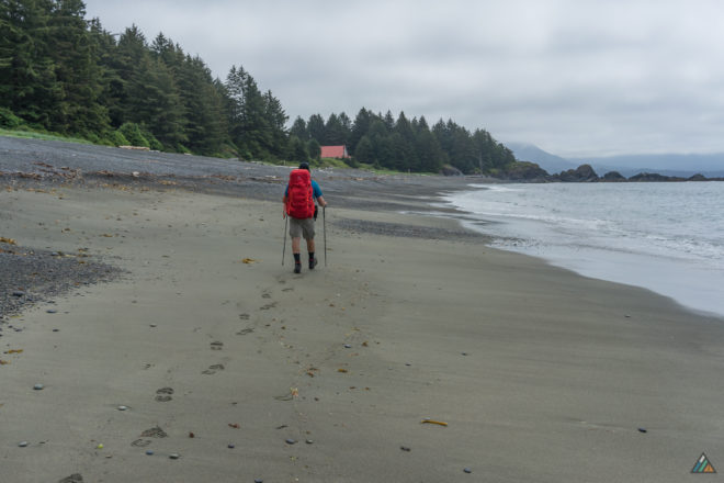
By camping close to Yuquot, we had an easy and relaxing final day that involved more sight-seeing and interpretive-plaque-reading than backpacking. Forgoing the alarm clock, we got up when we liked and had a leisurely morning on the beach. We chatted with a man and his mother from Belgium who were staying at the cabins and out for a morning walk. After packing up, we hiked our last kilometre to Yuquot and were greeted by two ravens and a wooden welcome figure. There is a large lawn up from the beach for camping, but the area was deserted. It felt special to experience the Nootka Trail with such seclusion. We visited the museum-church and found it empty too. The air was warm and still, and we could here the faint mewing of some baby animal in the direction of Jewitt Lake. We kept moving toward Friendly Cove and visited the Nootka Lighthouse. At last, the MV Uchuck III motored into the cove bringing humans and mechanical activity. We descended and found shade to rest in and watch the action. A few passengers thought that they were still on Vancouver Island, so we informed them that they were actually on Nootka Island! They were delighted by this news, as if they just got a bonus added to their trip. We watched island residents travel down the long dock to collect their supplies from the boat, and eventually it was our turn to board.
The journey back to Gold River on this historic working vessel was a fascinating part of the whole adventure. The crew was super-friendly and there were lots of places inside and out to rest and watch the action of Nootka Sound. We were treated to a Captain Cook history lesson, and saw two more whales! The trip lasted 90 minutes and was the perfect end to our journey. It was surreal to return back to the same dock that we left from on a floatplane just five days earlier. Our circuit finally complete, we changed into clean clothes and began the hunt for veggie burgers and fries. Mission accomplished!
