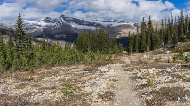
The first stop on our Rockies Road Trip this fall was Yoho National Park.
We renewed our annual park pass at the Park Visitor Centre in Field and got info from the ranger. He recommended the Iceline Trail as one of Yoho’s most spectacular full day hikes. The rain from the previous week had stopped, the sun was out, and the trails were drying. With our objective decided, breakfast was next! The Siding Cafe in Field served us excellent hash brown potatoes with peanut butter and jelly toast. Finally it was off to the Takakkaw Falls Trailhead to change clothes and organize gear for the day. One of the great things about hiking in the Canadian Rockies is quick alpine access. Mike and I drove our car up Yoho Valley Road to a stating elevation of 1510 m. On Vancouver Island, we generally access our alpine from sea level, Buttle Lake (220 m), or Paradise Meadows (1090 m). Such long approaches create strong island hikers. However, what a treat to start high, and climb even higher on a day hike! We planned to complete the loop in the counter-clockwise direction, starting low with the Yoho Valley Trail, climbing the Little Yoho Valley Trail to the Stanley Mitchell Hut, and finishing along the Iceline Trail before descending back to the trailhead. As part of emergency preparedness, we created backup plans with shorter loop trails using our topographical map.
Driving Directions
- Drive (855 km/9 h 50 min) from Victoria to Field via Trans-Canada Hwy/BC-1 E. 3 km east of Field turn onto Yoho Valley Road. Travel 13 km north on a narrow, steep road beside the Yoho River to the trailhead at Takakkaw Falls. The road is snowbound and closed to vehicles mid-October to mid-June; it is used by cross country skiers in the winter. Google Map
Permits & Fees
- All visitors to Yoho National Park require a Day Pass or Discovery Pass. We love our Annual Discovery Pass because it inspires to visit as many of Canada’s National Parks and Historic Sites as we can in a year!
Books & Maps
- Patton B. & Robinson B. Canadian Rockies Trail Guide. 8th ed. Summerthought Publishing; 2007. www.summerthought.com
- Scale 1:50,000. Lake Louise & Yoho. Gem Trek Publishing; 2012. www.gemtrek.com
Roue Conditions
Weather Updates
Trip Report
Iceline Trail via Little Yoho – September 21, 2015
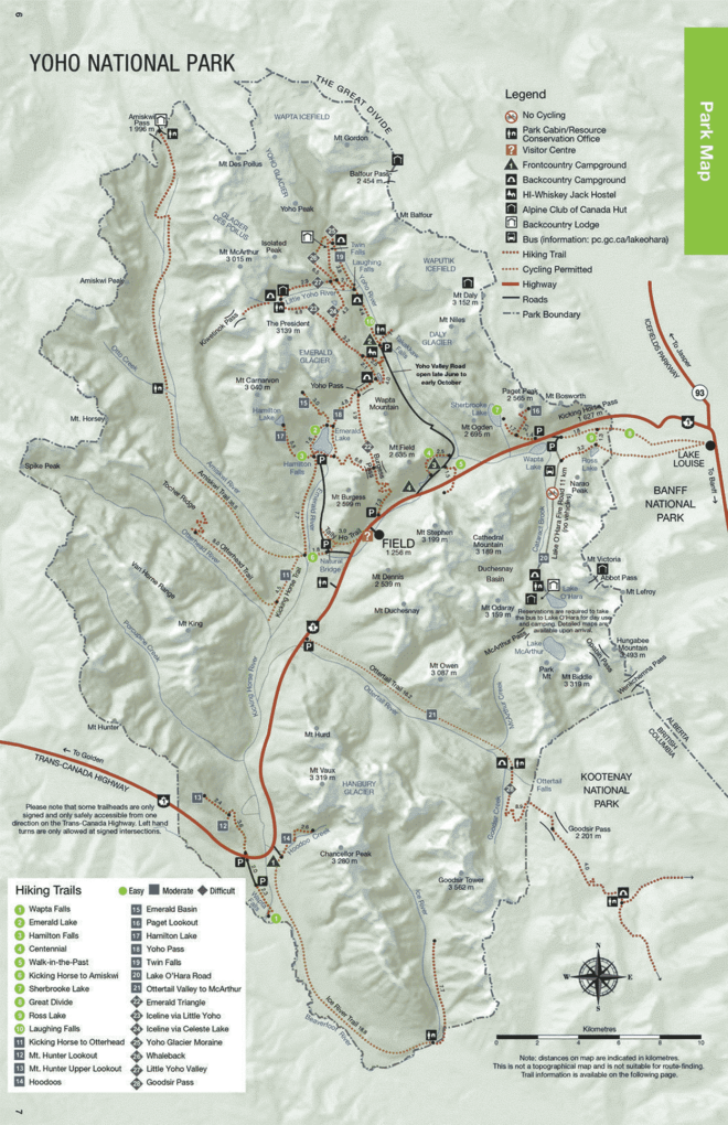
- Distance: 20 km
- Duration: 8 h 10 min
- Peak: 2252 m
- Gain: 889 m
Takakkaw Falls to Laughing Falls Camp (5 km)
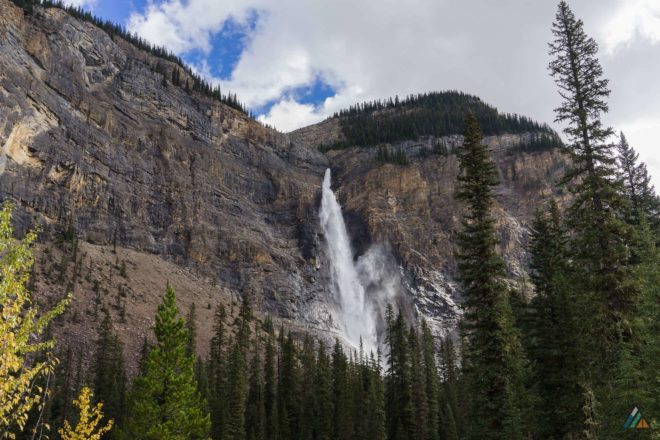
We got off to a late start because of the potato stop, but we felt strong and reasonably sure we could finish before dark. We caught views of swollen Takakkaw Falls from the trailhead (1510 m) before heading northeast. Our first leg was a beautiful warm up jaunt along the sunny banks of the Yoho River. Dry boardwalks carried us over braided streams. I was so excited to be on this famous Yoho hike! Part of the reason for this trip was to increase my comfort in alpine terrain. I’ve had many coastal experiences…bring on the tidal problems! But above the treeline, I feel an intensified wonder and remoteness. It’s a sensation of being very small in a vast, airy wilderness. My goal is to relax a little more in these places, knowing I am capable and prepared. After a few kilometres, Mike and I needed water so we filled up on the Yoho River. Two bodies of water flow into one, making half the river brown and half turquoise. We got a suspension of rock flour in our bottles, tasty minerals from the mountains! We always add a purification tablet to ensure that we protect ourselves from waterborne illnesses. A fellow at our Laughing Falls Camp (1608 m) break spot assured us there were no snow issues up on the Iceline. He was a hard-core Rockies hiker in trail runners, a fast-finisher of the Skyline Trail and the Rockwall Trail. With snow beta acquired, we started our ascent to the Alpine Club of Canada (ACC) Stanley Mitchell Hut.
Laughing Falls Camp to Stanley Mitchell Hut (5 km)
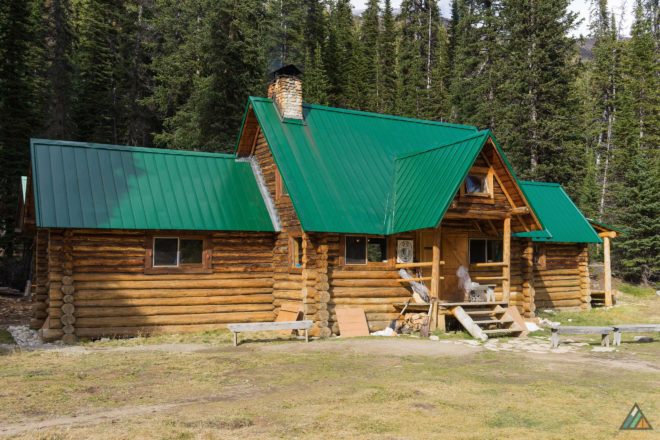
National Parks usually have well-engineered forest switchbacks…and the Little Yoho Valley Trail was no exception. Mike and I took our time hiking up, easily avoiding muddy spots and cross-trail creeks. Acquiring water was definitely not a problem that day. We saw some scratches on trees that we think might have been bear sign, but there was no hair on the bark to DNA test! There were several couples encountered along this section, all going down to the valley. Eventually, the trees thinned out and the ground became drier. We crossed more streams and the surrounding peaks came into view. The Stanley Mitchell Hut (2055 m) looked very comfy with its pretty green roof and fireplace blazing; there were campsites in the trees too. The air was cool and the atmosphere was happy since the sun was finally out. The group sounded pretty well stocked…one gentleman asked a lady if there were, “Any more butter tarts?” Those ACC folks really know how to wait out the rain. Sadly, we didn’t have any pastries in our backpacks. Crackers, peanut butter, dragon boat mix, and dried fruit fuelled us instead. With the President Range in clear view, I took a few bearings off some peaks with my compass. Because it was late in the afternoon, we kept our break short so we could clear the Iceline Trail in good light.
Stanley Mitchell Hut to Highline Junction (8 km)
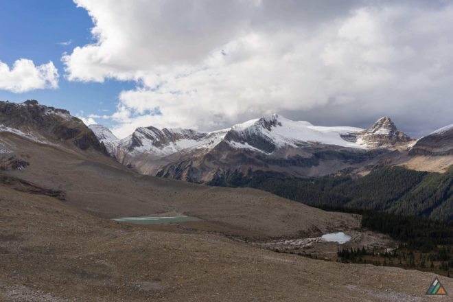
This leg was my favourite! We left the hut and hiked up more switchbacks to the alpine. It was surreal to clear the trees and abruptly enter the huge moraine field of the Emerald Glacier. It was even more amazing to hike so close to the glacier itself, though the ice has receded. The panoramas were endless, stunning, and unbelievable. Our high trail gave us excellent northern views of the President, the Vice President, Mount McArthur, Isolated Peak, and the Whaleback. I filled my water bottle in a windy drainage zone, shivering at the sudden temperature changes when the clouds obscured the sun. After passing between twin tarns we reached the high point of the Iceline Trail, a bump on a spur trail near a cairn (2252 m). Mike and I continued along the stunning Iceline, descending slightly now, our path stark and open. I felt that smallness again among the gray rocks. As we took in the brilliant scenery, a thundering rock fall broke the silence. We were well out of danger range, but the volume of rock surprised and fascinated us. Gravity! Before long, I took time to add a base-layer under my clothes and upgrade my gloves. Hand warmer packets are my precious mountain friends!
Highline Junction to Takakkaw Falls (3 km)
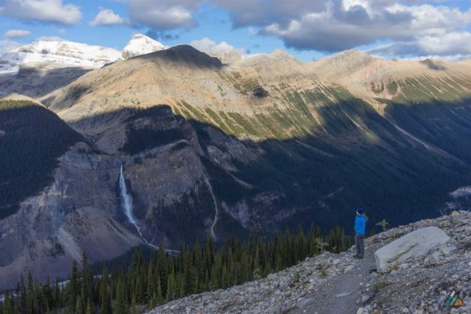
The Iceline Trail crosses a signpost junction (1925 m) with the Highline Trail. The Highline continues south to Yoho Lake and Yoho Pass, linking to the Emerald Triangle and Burgess Shale. We continued southeast past the junction, through a stark landscape of cairns, until we started to drop into the subalpine. The Daly Glacier, Mount Niles and Mount Balfour were spotted across the valley. Soon Mike and I were back in the forest on a steep switchback trail which levelled out at the Whiskey Jack Hostel. The sun was down and light was fading as we walked back to the Takakkaw Falls Trailhead…stopping to take in the raging falls from the now desolate visitor platform. It was incredible to me that just a few hours earlier, we saw the falls from high above. We were almost the last people at the trailhead! A group of intrepid photographers were the only other folks winding down the day there. Soon we had the car all fired up and motoring down the road to dinner. Our bodies basked in the post-hike-fatigue-glow that we love so much. All in all, this was one of the best day hikes I’ve ever done in my life. It had physical challenge, epic views, rugged peaks, glaciers, green rivers, big waterfalls, blue tarns, and lovely access. Neither of us had done that hike before, and we love exploring new places together. The Iceline Trail…a classic Canadian Rockies “must-do” hike!

