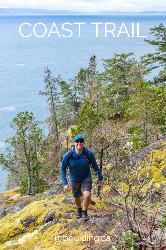
The Coast Trail in East Sooke Regional Park is the most spectacular coastal day-hike on southern Vancouver Island!
What makes this day-hike incredibly special is the feeling of wilderness that it invokes. Even though East Sooke Park is relatively close to urban centres, the endless views, abundant wildlife, ocean fresh air, and pounding waves immerse you deep into the natural world. Once you leave the busier trailhead zones, a true sense of remoteness can be experienced. Bring lots of water, start early, and take your time to enjoy this spectacular coastal hike!
Driving Directions
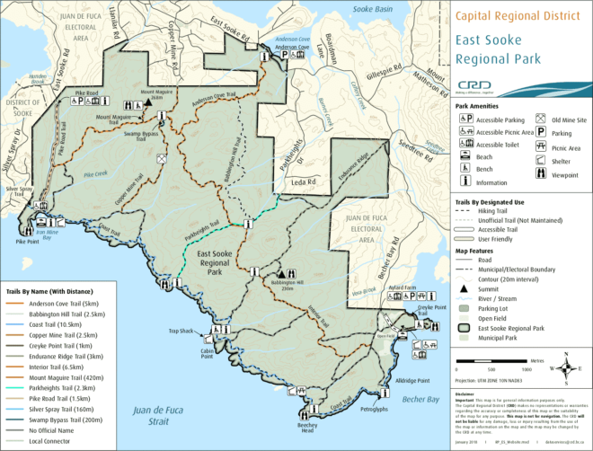
Allow approximately 60 minutes to drive from Victoria. Because the Coast Trail is a thru-hike, trailhead transportation requires extra logistics. If you wish to hike westbound (WEBO), start at the Aylard Farm Trailhead. If you wish to hike eastbound (EABO), start at the Pike Road Trailhead.
- Take two cars (requires at least two people). Drive to desired trailhead in two vehicles. Leave Car 1 at desired trailhead, then drive Car 2 to opposite trailhead. Start the trip. You will finish with Car 1 waiting for your group. Drive Car 1 back to collect Car 2.
- Hire a shuttle (can be done solo). Drive to desired trailhead. Get shuttled to the opposite trailhead, then start the trip. You will finish with your car waiting for you.
Aylard Farm Parking Lot: Follow the Trans-Canada Highway from Victoria, and take the #14 exit. Follow the Island Highway, which turns into Sooke Road. From Sooke Road, turn left on Gillespie Road. Turn left on East Sooke Road, then right on Becher Bay Road to access the Aylard Farm Parking Lot. Google Map
Pike Road Parking Lot: Follow the Trans-Canada Highway from Victoria, and take the #14 exit. Follow the Island Highway, which turns into Sooke Road. From Sooke Road, turn left on Gillespie Road. Turn right on East Sooke Road, then left on Pike Road to access the Pike Road Trailhead. Google Map
Of course, you can always park at one trailhead and “yo-yo” out-and-back to your car along the Coast Trail, or return via one of the interior trails. This plan makes for a way more strenuous day…bring extra nibbles
Trip Reports
Pike Road to Aylard Farm – April 7, 2019
- Distance: 13 km
- Duration: 5 h 35 min
- Peak: 78 m
- Gain: 520 m
- Route: CalTopo
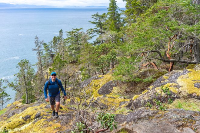
Introduction: East Sooke Regional Park is our favourite zone near Victoria to train for bigger trips. We almost always hike sections of the Coast Trail as part of interior loops, but we were eager to repeat the entire distance as a thru-hike. In May 2016, we hiked from Aylard Farm to Pike Road using a taxi shuttle. This time, we took two cars and hiked the opposite direction: Pike Road to Aylard Farm. Our objective was to get in some excellent physical training and to practice capturing videos and photos.
Conditions: The temperature was a brisk and sunny 8 degrees C when we exited the car at 1000 h. Pike Road was a nice trailhead to start at because it was quiet and we got 1 km of easy “highway” forest hiking for a warm up. Rain had fallen in this green portal overnight, making this section muddy. The sky was a mix of sun and cloudy which prevented us from overheating. We had a good breeze most of the day. The temperature when we finished at 1550 h was 13 degrees C.
Waypoints: Our main waypoints were the same as our previous trip but in reverse: Pike Road, Iron Mine Bay, Parkheights, Cabin Point, Beechey Head, Petroglyphs, and Aylard Farm.
Intensity: The section between Iron Mine Bay and Parkheights was of moderate difficulty due to ups and downs with scramble zones. Parkheights to Cabin Point is even more strenuous with even bigger ups and downs, but offers the most spectacular views. The route from Cabin Point to Beechey Head levels out and opens up a bit, with the final stretch to Aylard Farm the easiest of the day (and busiest with people).
Breaks: We took periodic micro-breaks to sort out gear or drink some water. Our longest break was a 25 minute luncheon on the sunny, high bluff west of Cabin Point. Peanut butter sandwiches and salt ’n’ vinegar chips were on the refuel menu.
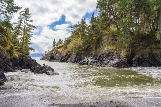
Wildlife: From the bird world we heard the ravens, Pacific wrens, varied thrushes, a Cooper’s hawk, bald eagles, and black oystercatchers. We even saw a tiny brown Pacific wren in a thicket of trees. In the ocean, we spotted several harbour seals looking back at us. No whales today! A pocket cove just east of Cabin Point had our most interesting wildlife sighting. The waves entering the cove were concentrated and rough. A Canada goose alternated between standing and settling on a miserable rocky perch, getting splashed by sea water. Why was he in that uncomfortable place? Mike looked across the waves to a small island and saw a second goose. She was on a nest, high and safe on a grassy patch. We guessed the male was keeping watch. Later, we looked back to the island and saw other Canada geese couples. A favourite spot to raise a bird family!
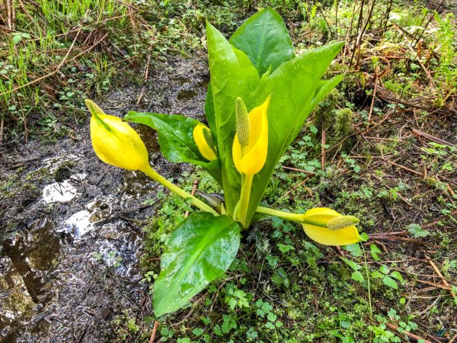
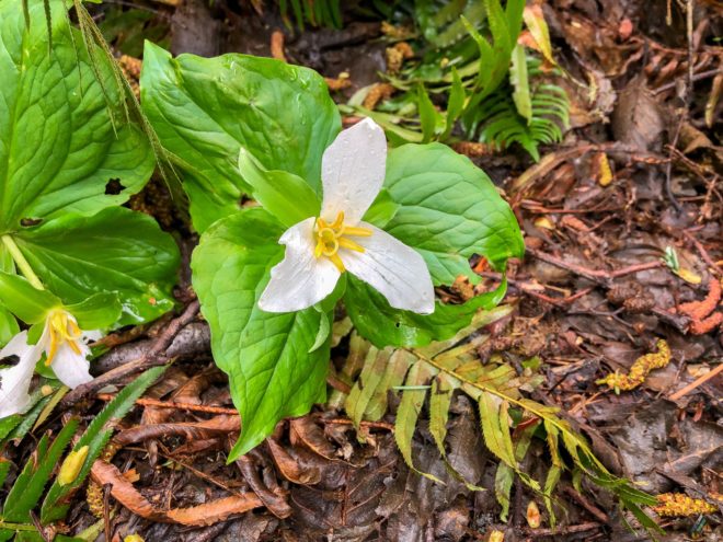
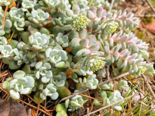
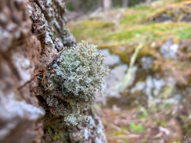
Plants: Skunk cabbage dominated the swamp zone near Iron Mine Bay. Some of the wildflowers starting to appear included shooting stars, trilliums, and white fawn lilies. We noticed a large variety of waxy, succulent-type plants that grew in thick carpets on the dry, rocky bluffs. Mosses and lichens were constant companions during our rocky scrambles.
Water: We expected the creeks and waterways to have more flow, especially since rain had fallen overnight and into the early morning. Most creeks were puddles with very low flow, a predictor of a very dry season ahead. Mike carried 2 L to drink and I carried 1.5 L.
Shoes: We wore breathable trail runners for this hike. There were a few muddy sections, but nothing to soak the feet. Much of the trail was on bare rock so soles with good grips are an asset.
Summary: We loved our second Coast Trail hike in East Sooke Park! Either direction is scenic and strenuous. Keep in mind the sun and time of day if you want to take photos in certain sections. We shaved 2 h 15 min off our attempt this time. Either we are fitter (hopefully) or we took fewer breaks!
Aylard Farm to Pike Road – May 14, 2016
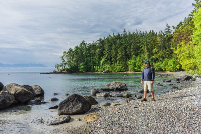
- Distance: 13 km
- Duration: 7 h 44 min
- Peak: 77 m
- Gain: 563 m
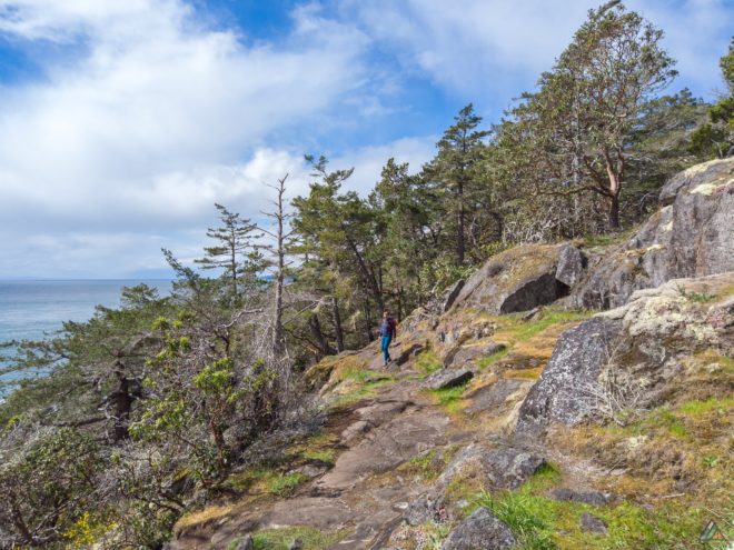
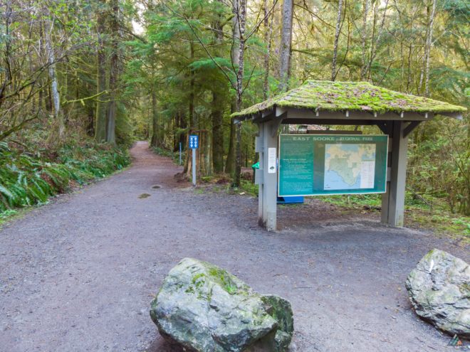
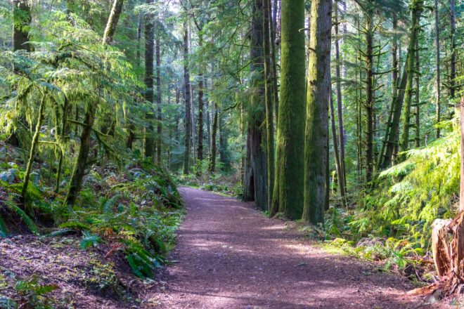
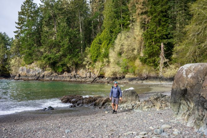
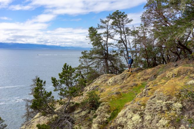
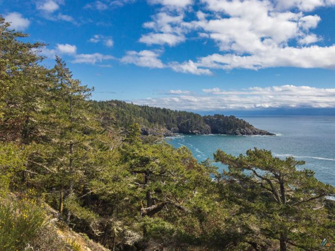
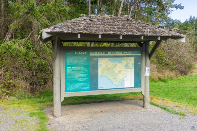
The Coast Trail was a gorgeous, challenging, winding, single track. The route repeatedly climbed high onto dry, windswept bluffs and plunged deep into rainforest ravines. Beautiful shoreline features constantly observed from the Coast Trail included pocket beaches, rocky bays, tide pools, sheltered coves, and thunderous surge channels. There were only a few short sections where hiking on the beach was possible. The uneven trail was a mix of dry soil, rock, conifer cones, pine needles, roots, and creek bed crossings. Some Class 2 scrambling was required up and down the rocks. A few stretches of trail had some decent cliff exposure (tripping would be a really bad idea). The section from Aylard Farm to Parkheights was extremely dry, while a few moist creeks appeared on approach to Iron Mine Bay. We left our hiking boots at home and wore lighter trail runners with good, grippy soles. We did not use trekking poles as there was no slippery beach hiking and it was better to have our hands free for scrambling. The rocky bluff trail sections were marked with yellow squares anchored to the rocks, often with arrows. The CRD has recently added colour trail maps to many of the junctions in East Sooke Regional Park.
Aylard Farm to Creyke Point
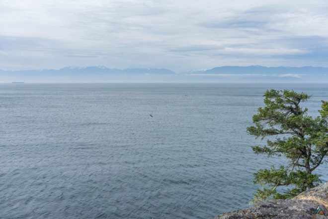
After leaving our car at the Iron Mine Bay Trailhead, we hired a shuttle to the Aylard Farm Trailhead (0.0 km). The morning was cool and breezy, with high scattered clouds. The Pacific wren sang his typewriter song and the conifer boughs roared overhead. Aylard Farm is a heritage apple orchard, and a popular spot for picnickers. The zone can be a serious gong show on weekends, with parked cars overflowing onto the access road. We recommend an early start if you want a parking spot at Aylard Farm. After sorting out our instruments, we hiked through the orchard field and swung left to include Creyke Point (0.9 km). This detour is worth the short extension to the Coast Trail for its great viewpoint.
Creyke Point to Petroglyphs
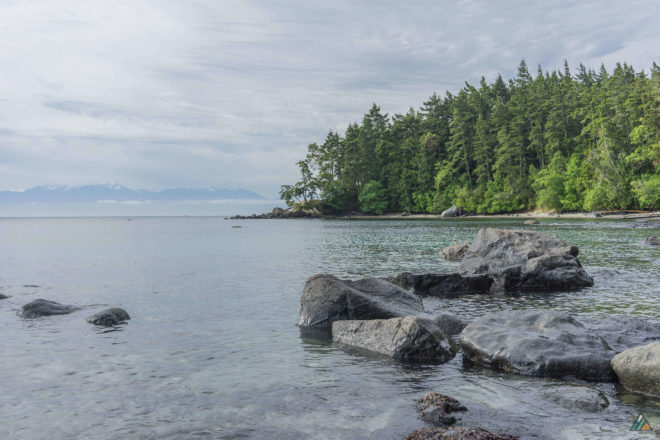
The official Coast Trail began after we descended from Creyke Point and entered the picnic area. We took advantage of a lowering tide and hiked along the pretty beach. Civilization had just disappeared from sight and it felt as though we were in a true wilderness. We kept our eyes on the Strait of Juan de Fuca to watch for gray whales, but didn’t have any luck. There were lots of robins on the beach, who reminded us of the ones we saw on the North Coast Route last spring. After encountering a headland, we climbed the bank up into groves of arbutus trees along the main trail. This section was nice and cruisey, with a warm, west wind making inky splotches on the dimpled grey ocean. We talked about how fast the snow was melting on the Olympic Mountains and formulated plans for future treks there.
Petroglyphs to Beechey Head
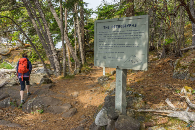
The petroglyphs (2.4 km) at Alldridge Point are a protected First Nations archeological artifact. Unfortunately, the petroglyphs have been spoiled with modern grafitti. The carved CRD sign reads: “What is a petroglyph? It is a picture carved into a rock. The word petroglyph mean “petros” – a stone, and “glyphs” – I carve. How is a petroglyph made? Usually by using one stone as a hammer. The historic artist pounded lines made of a series of small holes. The petroglyphs you see here, one possibly represents a seal in profile. The other, well, we will let you use your imagination.” This section of the Coast Trail was more open and exposed to the wind. We continued to hike in our warm puffy jackets. The stunted shore pines showed evidence of forceful winter storms.
Beechey Head to Cabin Point
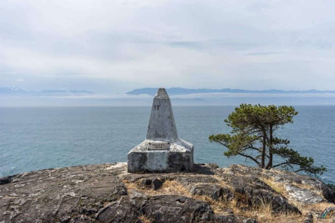
Beechey Head (3.7 km) is definitely worth the short scramble. It was a quick diversion to the left of the main trail. We climbed to the top of the headland for grand views and drying sunshine. It’s usually an excellent place to watch raptors soar, but the skies were empty that moment. Because we are geeks, were were excited to learn that Beechey Head is a reference that marks “Turning Point 10 of the Canadian and United States Boundary between the 49th parallel and the Pacific Ocean.” After leaving Beechey Head, the trail descended back down towards the ocean. We found the trail junction that travels inland back to Aylard Farm. This zone had a desolate picnic table and a small rain shelter. We stopped for lunch at a pretty cove just before Cabin Point and watched aspiring rock climbers boulder to the tidal island.
Cabin Point to Parkheights
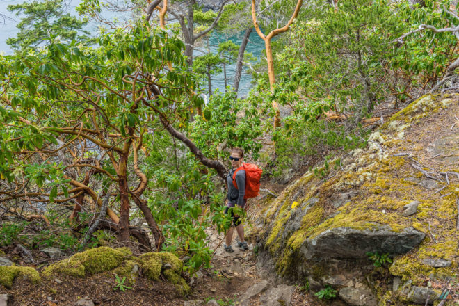
Cabin Point (6.2 km) a fantistic spot to stop and view marine wildlife. Once we watched a small humpback whale feed in the nearby bay. Sea lions frequent this area too. Cabin Point is named for a replica of a trap shack, similar to the type used by past fisherman. We had a brief look inside the cabin, then made our way up the hot, dry bluffs on the other side of a ravine. This section was probably the most strenuous of the day because of the longer ups and downs, scrambling, and exposure. The steep climbs to the higher viewpoints increased our chances of spotting whales on the horizon.
Parkheights to Iron Mine Bay
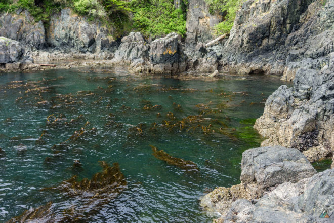
We insisted on a break at the Parkheights Viewpoint (7.8 km). Descending to the rocky shoreline rewarded us with a rustic bench rest on. The kelp forest was thick and golden in the green ocean. After leaving the dry bluffs at Parkheights, the trail leveled out and travelled through wetter temperate rainforest zones. A few creeks trickled to the ocean at last. Iron Mine Bay and the proximity of Donaldson Island marked the official end of the Coast Trail.
Conclusion
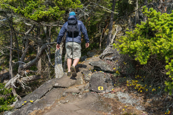
We have spent lots of time hiking in East Sooke Regional Park. There are so many fun trails that interconnect with each other creating endless combinations of loops. Anyone who enjoys coastal hiking and backpacking will love the Coast Trail. Even hard core West Coast Trail backpacking veterans or North Coast Trail fans would appreciate this refreshing and challenging day-hike.
- Excellent training. East Sooke Park is our preferred weekend training zone for bigger backpacking trips. The Coast Trail terrain was satisfactorily challenging. The constant ups and downs of the Coast Trail over many hours provided a great cardio workout and conditioning for summer backpacking.
- Gorgeous views. Views of the Pacific Ocean with a backdrop of the Olympic Mountains are plentiful. There is abundant marine wildlife to view in this vibrant coastal ecosystem.
- Bring lots of water. We brought only one litre of water each for our cool and windy day, with extra water stashed in the car. These volumes wouldn’t have been enough if the day was hotter. We were sufficiently hydrated before the trip.
- Start early. We took our time along the Coast Trail, taking breaks for fun and shooting photos. The whole trip takes us five to seven hours. Start early and enjoy the day!
